Chailland geodata
Chailland (Pays de la Loire) is a populated place; located in France in Europe/Paris (GMT+2) time zone. With population of 1,176 people, there are 7669 cities with bigger population in this country. Compared to other cities in France, 63.2% of cities are located further ↓South; 87.1% of cities are located further →East and 63.2% of cities have higher elevation than Chailland. Note1
Administrative division(s):
- Level 1: Pays de la Loire
- Level 2: Mayenne
- Level 3: Arrondissement de Mayenne
- Level 4: Chailland


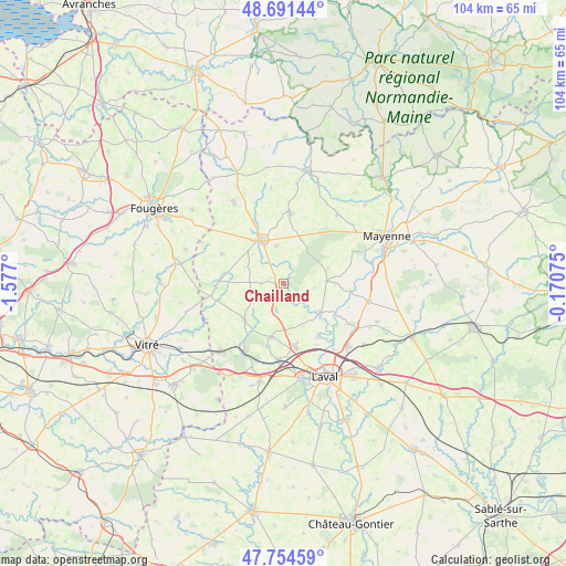
Chailland GPS coordinates[2]
48° 13' 30.576" North, 0° 52' 25.932" West
| Map corner | latitude | longitude |
|---|---|---|
| Upper-left | 48.69144°, | -1.577° |
| Center: | 48.22516°, | -0.87387° |
| Lower-right: | 47.75459°, | -0.17075° |
| Map W x H: | 104.2×104.2 km | = 64.7×64.7mi |
| max Lat: | 51.07786° ⇑36.8% North |
| Chailland: | 48.22516° |
| min Lat: | ⇓63.2% South 41.3874° |
| min Long | Chailland | max Long |
| -5.08615° | -0.87387° | 9.52242° |
| W 12.9%⇐ | ⇒87.1% E |
Elevation
Elevation of Chailland is 94 m = 308 ft, and this is 99.7 m = 327 ft below average elevation for this country.
| Max E: |
2333 m = 7654 ft | 63.2% |
| Avg. | 193.7 m = 635 ft | |
| Chailland | 94 m = 308 ft | |
Min E: |
-1 m = -3 ft | 36.8% |
See also: France elevation on elevation.city.
Geographical zone
Chailland is located in North temperate zone (between Tropic of Cancer and the Arctic Circle). Distance of this North polar circle is 2039 km =1267 mi to North.| Distance of | km | miles | from Chailland |
|---|---|---|---|
| North Pole | 4644.9 | 2886.2 | to North |
| Arctic Circle | 2039 | 1267 | to North |
| Tropic Cancer | 2756.2 | 1712.6 | to South |
| Equator | 5362.1 | 3331.9 | to South |


Nearby cities:
15 places around Chailland: (largest is in red/bold)
• Andouillé
8.6 km =5.3 mi,  128°
128°
• Ernée
9.1 km =5.7 mi,  332°
332°
• Juvigné
11.9 km =7.4 mi,  272°
272°
• La Baconnière
5.2 km =3.2 mi,  195°
195°
• La Croixille
13.8 km =8.6 mi,  260°
260°
• Le Bourgneuf-la-Forêt
9.9 km =6.2 mi,  225°
225°
• Montenay
7.1 km =4.4 mi,  348°
348°
• Port-Brillet
14.4 km =8.9 mi,  209°
209°
• Saint-Denis-de-Gastines
13.1 km =8.1 mi,  4°
4°
• Saint-Germain-le-Fouilloux
11.6 km =7.2 mi,  148°
148°
• Saint-Hilaire-du-Maine
4.2 km =2.6 mi, 271°
• Saint-Jean-sur-Mayenne
13.3 km =8.3 mi,  138°
138°
• Saint-Ouën-des-Toits
10.4 km =6.5 mi,  190°
190°
• Saint-Pierre-des-Landes
12.7 km =7.9 mi,  295°
295°
• Vautorte
8.8 km =5.5 mi,  19°
19°
Sources, notices
• [Note1] Compared only with cities in France existing in our database
• [Src1] Map data: © OpenStreetMap contributors (CC-BY-SA)
• [Src2] Other city data from geonames.org with taken over terms of usage.
• [Src3] Geographical zone / Annual Mean Temperature by Robert A. Rohde @ Wikipedia
