Boissy-Mauvoisin geodata
Boissy-Mauvoisin (Île-de-France) is a populated place; located in France in Europe/Paris (GMT+2) time zone. With population of 599 people, there are 13333 cities with bigger population in this country. Compared to other cities in France, 78.8% of cities are located further ↓South; 62% of cities are located further →East and 52.8% of cities have lower elevation than Boissy-Mauvoisin. Note1
Administrative division(s):
- Level 1: Île-de-France
- Level 2: Yvelines
- Level 3: Arrondissement de Mantes-la-Jolie
- Level 4: Boissy-Mauvoisin


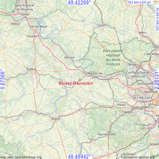
Boissy-Mauvoisin GPS coordinates[2]
48° 57' 47.484" North, 1° 34' 41.448" East
| Map corner | latitude | longitude |
|---|---|---|
| Upper-left | 49.42269°, | 0.87506° |
| Center: | 48.96319°, | 1.57818° |
| Lower-right: | 48.49942°, | 2.28131° |
| Map W x H: | 102.7×102.7 km | = 63.8×63.8mi |
| max Lat: | 51.07786° ⇑21.2% North |
| Boissy-Mauvoisin: | 48.96319° |
| min Lat: | ⇓78.8% South 41.3874° |
| min Long | Boissy-Mauvoisi | max Long |
| -5.08615° | 1.57818° | 9.52242° |
| W 38%⇐ | ⇒62% E |
Elevation
Elevation of Boissy-Mauvoisin is 142 m = 466 ft, and this is 51.7 m = 170 ft below average elevation for this country.
| Max E: |
2333 m = 7654 ft | 47.2% |
| Avg. | 193.7 m = 635 ft | |
| Boissy-Mauvoisin | 142 m = 466 ft | |
Min E: |
-1 m = -3 ft | 52.8% |
See also: France elevation on elevation.city.
Geographical zone
Boissy-Mauvoisin is located in North temperate zone (between Tropic of Cancer and the Arctic Circle). Distance of this North polar circle is 1957 km =1216 mi to North.| Distance of | km | miles | from Boissy-Mauvoisin |
|---|---|---|---|
| North Pole | 4562.9 | 2835.3 | to North |
| Arctic Circle | 1957 | 1216 | to North |
| Tropic Cancer | 2838.3 | 1763.6 | to South |
| Equator | 5444.2 | 3382.9 | to South |


Nearby cities:
15 places around Boissy-Mauvoisin: (largest is in red/bold)
• Bonnières-sur-Seine
8 km =5 mi,  0°
0°
• Bréval
3.8 km =2.4 mi,  239°
239°
• Buchelay
7 km =4.3 mi,  75°
75°
• Dammartin-en-Serve
7.3 km =4.5 mi,  155°
155°
• Gilles
7.3 km =4.5 mi,  219°
219°
• Guernes
6.8 km =4.2 mi,  38°
38°
• Jouy-Mauvoisin
5.3 km =3.3 mi,  74°
74°
• La Villeneuve-en-Chevrie
6.9 km =4.3 mi,  326°
326°
• Lommoye
5.8 km =3.6 mi,  305°
305°
• Longnes
4.8 km =3 mi,  172°
172°
• Magnanville
7.3 km =4.5 mi,  85°
85°
• Neauphlette
5.2 km =3.2 mi,  227°
227°
• Rosny-sur-Seine
5.5 km =3.4 mi, 44°
• Soindres
7.1 km =4.4 mi, 94°
• Villiers-en-Désœuvre
5.9 km =3.7 mi,  255°
255°
Sources, notices
• [Note1] Compared only with cities in France existing in our database
• [Src1] Map data: © OpenStreetMap contributors (CC-BY-SA)
• [Src2] Other city data from geonames.org with taken over terms of usage.
• [Src3] Geographical zone / Annual Mean Temperature by Robert A. Rohde @ Wikipedia
