Bréval geodata
Bréval (Île-de-France) is a populated place; located in France in Europe/Paris (GMT+2) time zone. With population of 1,735 people, there are 5441 cities with bigger population in this country. Compared to other cities in France, 78.5% of cities are located further ↓South; 62.6% of cities are located further →East and 51.4% of cities have higher elevation than Bréval. Note1
Administrative division(s):
- Level 1: Île-de-France
- Level 2: Yvelines
- Level 3: Arrondissement de Mantes-la-Jolie
- Level 4: Bréval


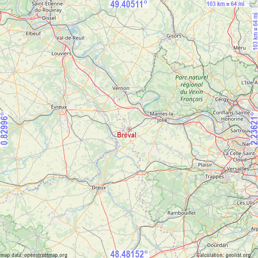
Bréval GPS coordinates[2]
48° 56' 43.62" North, 1° 31' 59.124" East
| Map corner | latitude | longitude |
|---|---|---|
| Upper-left | 49.40511°, | 0.82996° |
| Center: | 48.94545°, | 1.53309° |
| Lower-right: | 48.48152°, | 2.23621° |
| Map W x H: | 102.7×102.7 km | = 63.8×63.8mi |
| max Lat: | 51.07786° ⇑21.5% North |
| Bréval: | 48.94545° |
| min Lat: | ⇓78.5% South 41.3874° |
| min Long | Bréval | max Long |
| -5.08615° | 1.53309° | 9.52242° |
| W 37.4%⇐ | ⇒62.6% E |
Elevation
Elevation of Bréval is 127 m = 417 ft, and this is 66.7 m = 219 ft below average elevation for this country.
| Max E: |
2333 m = 7654 ft | 51.4% |
| Avg. | 193.7 m = 635 ft | |
| Bréval | 127 m = 417 ft | |
Min E: |
-1 m = -3 ft | 48.6% |
See also: France elevation on elevation.city.
Geographical zone
Bréval is located in North temperate zone (between Tropic of Cancer and the Arctic Circle). Distance of this North polar circle is 1959 km =1217.3 mi to North.| Distance of | km | miles | from Bréval |
|---|---|---|---|
| North Pole | 4564.8 | 2836.4 | to North |
| Arctic Circle | 1959 | 1217.3 | to North |
| Tropic Cancer | 2836.3 | 1762.4 | to South |
| Equator | 5442.2 | 3381.6 | to South |


Nearby cities:
15 places around Bréval: (largest is in red/bold)
• Boissy-Mauvoisin
3.8 km =2.4 mi,  59°
59°
• Breuilpont
7.9 km =4.9 mi,  285°
285°
• Bueil
6.8 km =4.2 mi,  257°
257°
• Dammartin-en-Serve
7.9 km =4.9 mi,  126°
126°
• Garennes-sur-Eure
7.9 km =4.9 mi,  241°
241°
• Gilles
3.9 km =2.4 mi,  200°
200°
• Guainville
4.4 km =2.7 mi,  224°
224°
• Ivry-la-Bataille
8.8 km =5.5 mi, 217°
• Jouy-Mauvoisin
9.1 km =5.7 mi,  68°
68°
• La Villeneuve-en-Chevrie
7.7 km =4.8 mi,  356°
356°
• Lommoye
5.6 km =3.5 mi,  344°
344°
• Longnes
4.9 km =3 mi, 125°
• Neauphlette
1.6 km =1 mi, 198°
• Rosny-sur-Seine
9.3 km =5.8 mi,  50°
50°
• Villiers-en-Désœuvre
2.5 km =1.6 mi,  281°
281°
Sources, notices
• [Note1] Compared only with cities in France existing in our database
• [Src1] Map data: © OpenStreetMap contributors (CC-BY-SA)
• [Src2] Other city data from geonames.org with taken over terms of usage.
• [Src3] Geographical zone / Annual Mean Temperature by Robert A. Rohde @ Wikipedia
