Villiers-en-Désœuvre geodata
Villiers-en-Désœuvre (Normandy) is a populated place; located in France in Europe/Paris (GMT+2) time zone. With population of 848 people, there are 10102 cities with bigger population in this country. Compared to other cities in France, 78.5% of cities are located further ↓South; 63% of cities are located further →East and 50.8% of cities have lower elevation than Villiers-en-Désœuvre. Note1
Administrative division(s):
- Level 1: Normandy
- Level 2: Département de l'Eure
- Level 3: Les Andelys
- Level 4: Villiers-en-Désœuvre


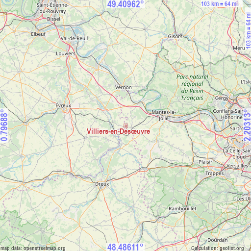
Villiers-en-Désœuvre GPS coordinates[2]
48° 57' 0" North, 1° 30' 0" East
| Map corner | latitude | longitude |
|---|---|---|
| Upper-left | 49.40962°, | 0.79688° |
| Center: | 48.95°, | 1.5° |
| Lower-right: | 48.48611°, | 2.20313° |
| Map W x H: | 102.7×102.7 km | = 63.8×63.8mi |
| max Lat: | 51.07786° ⇑21.5% North |
| Villiers-en-Désœuvre: | 48.95° |
| min Lat: | ⇓78.5% South 41.3874° |
| min Long | Villiers-en-Dé | max Long |
| -5.08615° | 1.5° | 9.52242° |
| W 37%⇐ | ⇒63% E |
Elevation
Elevation of Villiers-en-Désœuvre is 135 m = 443 ft, and this is 58.7 m = 193 ft below average elevation for this country.
| Max E: |
2333 m = 7654 ft | 49.2% |
| Avg. | 193.7 m = 635 ft | |
| Villiers-en-Désœuvre | 135 m = 443 ft | |
Min E: |
-1 m = -3 ft | 50.8% |
See also: France elevation on elevation.city.
Geographical zone
Villiers-en-Désœuvre is located in North temperate zone (between Tropic of Cancer and the Arctic Circle). Distance of this North polar circle is 1958.4 km =1216.9 mi to North.| Distance of | km | miles | from Villiers-en-Désœuvre |
|---|---|---|---|
| North Pole | 4564.3 | 2836.1 | to North |
| Arctic Circle | 1958.4 | 1216.9 | to North |
| Tropic Cancer | 2836.8 | 1762.7 | to South |
| Equator | 5442.7 | 3381.9 | to South |


Nearby cities:
15 places around Villiers-en-Désœuvre: (largest is in red/bold)
• Boissy-Mauvoisin
5.9 km =3.7 mi,  75°
75°
• Breuilpont
5.4 km =3.4 mi,  286°
286°
• Bréval
2.5 km =1.6 mi,  101°
101°
• Bueil
4.7 km =2.9 mi,  244°
244°
• Dammartin-en-Serve
10.2 km =6.3 mi,  120°
120°
• Garennes-sur-Eure
6.2 km =3.9 mi,  226°
226°
• Gilles
4.3 km =2.7 mi,  165°
165°
• Guainville
3.7 km =2.3 mi,  190°
190°
• Ivry-la-Bataille
8 km =5 mi,  201°
201°
• La Couture-Boussey
9.2 km =5.7 mi, 229°
• La Villeneuve-en-Chevrie
7.5 km =4.7 mi,  15°
15°
• Lommoye
4.9 km =3 mi,  11°
11°
• Longnes
7.2 km =4.5 mi, 117°
• Neauphlette
2.8 km =1.7 mi,  137°
137°
• Oulins
9.7 km =6 mi, 192°
Sources, notices
• [Note1] Compared only with cities in France existing in our database
• [Src1] Map data: © OpenStreetMap contributors (CC-BY-SA)
• [Src2] Other city data from geonames.org with taken over terms of usage.
• [Src3] Geographical zone / Annual Mean Temperature by Robert A. Rohde @ Wikipedia
