Lavérune geodata
Lavérune (Occitanie) is a populated place; located in France in Europe/Paris (GMT+2) time zone. With population of 2,760 people, there are 3543 cities with bigger population in this country. Compared to other cities in France, 92% of cities are located further ↑North; 66.4% of cities are located further ←West and 85.9% of cities have higher elevation than Lavérune. Note1
Administrative division(s):
- Level 1: Occitanie
- Level 2: Département de l'Hérault
- Level 3: Arrondissement of Montpellier
- Level 4: Lavérune


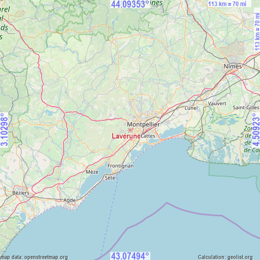
Lavérune GPS coordinates[2]
43° 35' 11.004" North, 3° 48' 21.996" East
| Map corner | latitude | longitude |
|---|---|---|
| Upper-left | 44.09353°, | 3.10298° |
| Center: | 43.58639°, | 3.80611° |
| Lower-right: | 43.07494°, | 4.50923° |
| Map W x H: | 113.3×113.3 km | = 70.4×70.4mi |
| max Lat: | 51.07786° ⇑92% North |
| Lavérune: | 43.58639° |
| min Lat: | ⇓8% South 41.3874° |
| min Long | Lavérune | max Long |
| -5.08615° | 3.80611° | 9.52242° |
| W 66.4%⇐ | ⇒33.6% E |
Elevation
Elevation of Lavérune is 40 m = 131 ft, and this is 153.7 m = 504 ft below average elevation for this country.
| Max E: |
2333 m = 7654 ft | 85.9% |
| Avg. | 193.7 m = 635 ft | |
| Lavérune | 40 m = 131 ft | |
Min E: |
-1 m = -3 ft | 14.1% |
See also: France elevation on elevation.city.
Geographical zone
Lavérune is located in North temperate zone (between Tropic of Cancer and the Arctic Circle). Distance of this Northern Tropic circle is 2240.4 km =1392.1 mi to South.| Distance of | km | miles | from Lavérune |
|---|---|---|---|
| North Pole | 5160.7 | 3206.7 | to North |
| Arctic Circle | 2554.8 | 1587.5 | to North |
| Tropic Cancer | 2240.4 | 1392.1 | to South |
| Equator | 4846.4 | 3011.4 | to South |


Nearby cities:
15 places around Lavérune: (largest is in red/bold)
• Castelnau-le-Lez
9.2 km =5.7 mi,  55°
55°
• Cournonsec
9.1 km =5.7 mi,  243°
243°
• Cournonterral
7.6 km =4.7 mi,  246°
246°
• Fabrègues
4.6 km =2.9 mi,  211°
211°
• Grabels
6.9 km =4.3 mi,  354°
354°
• Juvignac
3.1 km =1.9 mi,  6°
6°
• Lattes
8.2 km =5.1 mi,  104°
104°
• Mireval
8.7 km =5.4 mi,  182°
182°
• Montferrier-sur-Lez
9.8 km =6.1 mi,  23°
23°
• Montpellier
6.3 km =3.9 mi, 64°
• Murviel-lès-Montpellier
5.9 km =3.7 mi,  290°
290°
• Pignan
3.7 km =2.3 mi,  265°
265°
• Saint-Jean-de-Védas
1.9 km =1.2 mi,  121°
121°
• Saussan
3 km =1.9 mi, 237°
• Villeneuve-lès-Maguelone
7.7 km =4.8 mi,  140°
140°
Sources, notices
• [Note1] Compared only with cities in France existing in our database
• [Src1] Map data: © OpenStreetMap contributors (CC-BY-SA)
• [Src2] Other city data from geonames.org with taken over terms of usage.
• [Src3] Geographical zone / Annual Mean Temperature by Robert A. Rohde @ Wikipedia
