Montpellier geodata
Montpellier (Occitanie) is a seat of a second-order administrative division; located in France in Europe/Paris (GMT+2) time zone. With population of 248,252 people, there are 7 cities with bigger population in this country. Compared to other cities in France, 91.7% of cities are located further ↑North; 66.8% of cities are located further ←West and 79.4% of cities have higher elevation than Montpellier. Note1
Administrative division(s):
- Level 1: Occitanie
- Level 2: Département de l'Hérault
- Level 3: Arrondissement of Montpellier
- Level 4: Montpellier


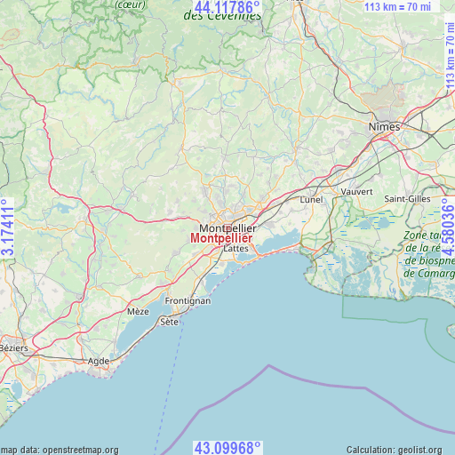
Montpellier GPS coordinates[2]
43° 36' 39.312" North, 3° 52' 38.028" East
| Map corner | latitude | longitude |
|---|---|---|
| Upper-left | 44.11786°, | 3.17411° |
| Center: | 43.61092°, | 3.87723° |
| Lower-right: | 43.09968°, | 4.58036° |
| Map W x H: | 113.2×113.2 km | = 70.3×70.3mi |
| max Lat: | 51.07786° ⇑91.7% North |
| Montpellier: | 43.61092° |
| min Lat: | ⇓8.3% South 41.3874° |
| min Long | Montpellier | max Long |
| -5.08615° | 3.87723° | 9.52242° |
| W 66.8%⇐ | ⇒33.2% E |
Elevation
Elevation of Montpellier is 56 m = 184 ft, and this is 137.7 m = 452 ft below average elevation for this country.
| Max E: |
2333 m = 7654 ft | 79.4% |
| Avg. | 193.7 m = 635 ft | |
| Montpellier | 56 m = 184 ft | |
Min E: |
-1 m = -3 ft | 20.6% |
See also: Montpellier elevation on elevation.city.
Geographical zone
Montpellier is located in North temperate zone (between Tropic of Cancer and the Arctic Circle). Distance of this Northern Tropic circle is 2243.2 km =1393.9 mi to South.| Distance of | km | miles | from Montpellier |
|---|---|---|---|
| North Pole | 5158 | 3205 | to North |
| Arctic Circle | 2552.1 | 1585.8 | to North |
| Tropic Cancer | 2243.2 | 1393.9 | to South |
| Equator | 4849.1 | 3013.1 | to South |


Nearby cities:
15 places around Montpellier: (largest is in red/bold)
• Castelnau-le-Lez
3.1 km =1.9 mi,  36°
36°
• Clapiers
5.4 km =3.4 mi,  10°
10°
• Grabels
7.5 km =4.7 mi,  303°
303°
• Jacou
6.3 km =3.9 mi,  26°
26°
• Juvignac
5.4 km =3.4 mi,  273°
273°
• Lattes
5.3 km =3.3 mi,  155°
155°
• Lavérune
6.3 km =3.9 mi,  244°
244°
• Le Crès
6.5 km =4 mi,  50°
50°
• Montferrier-sur-Lez
6.5 km =4 mi,  343°
343°
• Pérols
8 km =5 mi,  131°
131°
• Saint-Aunès
7.9 km =4.9 mi,  64°
64°
• Saint-Clément-de-Rivière
8.8 km =5.5 mi, 336°
• Saint-Jean-de-Védas
5.5 km =3.4 mi,  228°
228°
• Vendargues
9.1 km =5.7 mi, 54°
• Villeneuve-lès-Maguelone
8.7 km =5.4 mi,  185°
185°
Sources, notices
• [Note1] Compared only with cities in France existing in our database
• [Src1] Map data: © OpenStreetMap contributors (CC-BY-SA)
• [Src2] Other city data from geonames.org with taken over terms of usage.
• [Src3] Geographical zone / Annual Mean Temperature by Robert A. Rohde @ Wikipedia
