Lattes geodata
Lattes (Occitanie) is a populated place; located in France in Europe/Paris (GMT+2) time zone. With population of 17,390 people, there are 549 cities with bigger population in this country. Compared to other cities in France, 92.2% of cities are located further ↑North; 67% of cities are located further ←West and 99.3% of cities have higher elevation than Lattes. Note1
Administrative division(s):
- Level 1: Occitanie
- Level 2: Département de l'Hérault
- Level 3: Arrondissement of Montpellier
- Level 4: Lattes


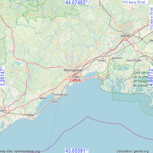
Lattes GPS coordinates[2]
43° 34' 3.072" North, 3° 54' 16.56" East
| Map corner | latitude | longitude |
|---|---|---|
| Upper-left | 44.07482°, | 3.20147° |
| Center: | 43.56752°, | 3.9046° |
| Lower-right: | 43.05591°, | 4.60772° |
| Map W x H: | 113.3×113.3 km | = 70.4×70.4mi |
| max Lat: | 51.07786° ⇑92.2% North |
| Lattes: | 43.56752° |
| min Lat: | ⇓7.8% South 41.3874° |
| min Long | Lattes | max Long |
| -5.08615° | 3.9046° | 9.52242° |
| W 67%⇐ | ⇒33% E |
Elevation
Elevation of Lattes is 5 m = 16 ft, and this is 188.7 m = 619 ft below average elevation for this country.
| Max E: |
2333 m = 7654 ft | 99.3% |
| Avg. | 193.7 m = 635 ft | |
| Lattes | 5 m = 16 ft | |
Min E: |
-1 m = -3 ft | 0.7% |
See also: France elevation on elevation.city.
Geographical zone
Lattes is located in North temperate zone (between Tropic of Cancer and the Arctic Circle). Distance of this Northern Tropic circle is 2238.3 km =1390.8 mi to South.| Distance of | km | miles | from Lattes |
|---|---|---|---|
| North Pole | 5162.8 | 3208 | to North |
| Arctic Circle | 2556.9 | 1588.8 | to North |
| Tropic Cancer | 2238.3 | 1390.8 | to South |
| Equator | 4844.3 | 3010.1 | to South |


Nearby cities:
15 places around Lattes: (largest is in red/bold)
• Castelnau-le-Lez
7.3 km =4.5 mi,  357°
357°
• Clapiers
10.2 km =6.3 mi,  352°
352°
• Fabrègues
10.5 km =6.5 mi,  259°
259°
• Jacou
10.5 km =6.5 mi,  3°
3°
• Juvignac
9.2 km =5.7 mi,  304°
304°
• Lavérune
8.2 km =5.1 mi,  284°
284°
• Le Crès
9.4 km =5.8 mi,  17°
17°
• Mauguio
10 km =6.2 mi,  55°
55°
• Montpellier
5.3 km =3.3 mi,  335°
335°
• Palavas-les-Flots
4.7 km =2.9 mi,  157°
157°
• Pérols
3.9 km =2.4 mi,  97°
97°
• Saint-Aunès
9.5 km =5.9 mi,  31°
31°
• Saint-Jean-de-Védas
6.4 km =4 mi, 280°
• Saussan
10.5 km =6.5 mi,  272°
272°
• Villeneuve-lès-Maguelone
4.9 km =3 mi,  218°
218°
Sources, notices
• [Note1] Compared only with cities in France existing in our database
• [Src1] Map data: © OpenStreetMap contributors (CC-BY-SA)
• [Src2] Other city data from geonames.org with taken over terms of usage.
• [Src3] Geographical zone / Annual Mean Temperature by Robert A. Rohde @ Wikipedia
