Lauzach geodata
Lauzach (Brittany) is a populated place; located in France in Europe/Paris (GMT+2) time zone. With population of 588 people, there are 13513 cities with bigger population in this country. Compared to other cities in France, 52.8% of cities are located further ↓South; 96.3% of cities are located further →East and 83.4% of cities have higher elevation than Lauzach. Note1
Administrative division(s):
- Level 1: Brittany
- Level 2: Morbihan
- Level 3: Arrondissement de Vannes
- Level 4: Lauzach


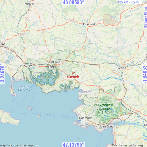
Lauzach GPS coordinates[2]
47° 36' 50.724" North, 2° 32' 37.14" West
| Map corner | latitude | longitude |
|---|---|---|
| Upper-left | 48.08593°, | -3.24678° |
| Center: | 47.61409°, | -2.54365° |
| Lower-right: | 47.13795°, | -1.84053° |
| Map W x H: | 105.4×105.4 km | = 65.5×65.5mi |
| max Lat: | 51.07786° ⇑47.2% North |
| Lauzach: | 47.61409° |
| min Lat: | ⇓52.8% South 41.3874° |
| min Long | Lauzach | max Long |
| -5.08615° | -2.54365° | 9.52242° |
| W 3.7%⇐ | ⇒96.3% E |
Elevation
Elevation of Lauzach is 46 m = 151 ft, and this is 147.7 m = 485 ft below average elevation for this country.
| Max E: |
2333 m = 7654 ft | 83.4% |
| Avg. | 193.7 m = 635 ft | |
| Lauzach | 46 m = 151 ft | |
Min E: |
-1 m = -3 ft | 16.6% |
See also: France elevation on elevation.city.
Geographical zone
Lauzach is located in North temperate zone (between Tropic of Cancer and the Arctic Circle). Distance of this North polar circle is 2107 km =1309.2 mi to North.| Distance of | km | miles | from Lauzach |
|---|---|---|---|
| North Pole | 4712.9 | 2928.5 | to North |
| Arctic Circle | 2107 | 1309.2 | to North |
| Tropic Cancer | 2688.3 | 1670.4 | to South |
| Equator | 5294.2 | 3289.7 | to South |


Nearby cities:
15 places around Lauzach: (largest is in red/bold)
• Ambon
6.8 km =4.2 mi,  187°
187°
• Berric
2.7 km =1.7 mi,  36°
36°
• Billiers
10.2 km =6.3 mi,  155°
155°
• Damgan
11 km =6.8 mi, 193°
• La Trinité-Surzur
3.8 km =2.4 mi,  252°
252°
• La Vraie-Croix
8.4 km =5.2 mi,  0°
0°
• Le Guerno
10.8 km =6.7 mi,  108°
108°
• Muzillac
8.1 km =5 mi,  144°
144°
• Noyal-Muzillac
7.1 km =4.4 mi, 110°
• Noyalo
10 km =6.2 mi,  267°
267°
• Questembert
8.7 km =5.4 mi,  51°
51°
• Sulniac
7 km =4.3 mi,  342°
342°
• Surzur
7.5 km =4.7 mi,  238°
238°
• Theix
8.3 km =5.2 mi,  281°
281°
• Treffléan
9.1 km =5.7 mi,  325°
325°
Sources, notices
• [Note1] Compared only with cities in France existing in our database
• [Src1] Map data: © OpenStreetMap contributors (CC-BY-SA)
• [Src2] Other city data from geonames.org with taken over terms of usage.
• [Src3] Geographical zone / Annual Mean Temperature by Robert A. Rohde @ Wikipedia
