La Trinité-Surzur geodata
La Trinité-Surzur (Brittany) is a populated place; located in France in Europe/Paris (GMT+2) time zone. With population of 606 people, there are 13224 cities with bigger population in this country. Compared to other cities in France, 52.7% of cities are located further ↓South; 96.5% of cities are located further →East and 88.6% of cities have higher elevation than La Trinité-Surzur. Note1
Administrative division(s):
- Level 1: Brittany
- Level 2: Morbihan
- Level 3: Arrondissement de Vannes
- Level 4: La Trinité-Surzur


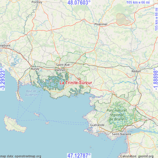
La Trinité-Surzur GPS coordinates[2]
47° 36' 14.76" North, 2° 35' 31.596" West
| Map corner | latitude | longitude |
|---|---|---|
| Upper-left | 48.07603°, | -3.29523° |
| Center: | 47.6041°, | -2.59211° |
| Lower-right: | 47.12787°, | -1.88898° |
| Map W x H: | 105.4×105.4 km | = 65.5×65.5mi |
| max Lat: | 51.07786° ⇑47.3% North |
| La Trinité-Surzur: | 47.6041° |
| min Lat: | ⇓52.7% South 41.3874° |
| min Long | La Trinité-Sur | max Long |
| -5.08615° | -2.59211° | 9.52242° |
| W 3.5%⇐ | ⇒96.5% E |
Elevation
Elevation of La Trinité-Surzur is 33 m = 108 ft, and this is 160.7 m = 527 ft below average elevation for this country.
| Max E: |
2333 m = 7654 ft | 88.6% |
| Avg. | 193.7 m = 635 ft | |
| La Trinité-Surzur | 33 m = 108 ft | |
Min E: |
-1 m = -3 ft | 11.4% |
See also: France elevation on elevation.city.
Geographical zone
La Trinité-Surzur is located in North temperate zone (between Tropic of Cancer and the Arctic Circle). Distance of this North polar circle is 2108.1 km =1309.9 mi to North.| Distance of | km | miles | from La Trinité-Surzur |
|---|---|---|---|
| North Pole | 4714 | 2929.1 | to North |
| Arctic Circle | 2108.1 | 1309.9 | to North |
| Tropic Cancer | 2687.2 | 1669.7 | to South |
| Equator | 5293.1 | 3289 | to South |


Nearby cities:
15 places around La Trinité-Surzur: (largest is in red/bold)
• Ambon
6.3 km =3.9 mi,  153°
153°
• Berric
6.1 km =3.8 mi,  58°
58°
• Damgan
9.6 km =6 mi,  173°
173°
• La Vraie-Croix
10.2 km =6.3 mi,  21°
21°
• Lauzach
3.8 km =2.4 mi,  72°
72°
• Le Hézo
8.5 km =5.3 mi,  255°
255°
• Le Tour-du-Parc
9.7 km =6 mi,  204°
204°
• Muzillac
10 km =6.2 mi,  123°
123°
• Noyal-Muzillac
10.3 km =6.4 mi,  97°
97°
• Noyalo
6.4 km =4 mi,  275°
275°
• Saint-Armel
9.4 km =5.8 mi,  248°
248°
• Sulniac
7.9 km =4.9 mi,  11°
11°
• Surzur
4 km =2.5 mi,  224°
224°
• Theix
5.3 km =3.3 mi,  301°
301°
• Treffléan
8.8 km =5.5 mi,  349°
349°
Sources, notices
• [Note1] Compared only with cities in France existing in our database
• [Src1] Map data: © OpenStreetMap contributors (CC-BY-SA)
• [Src2] Other city data from geonames.org with taken over terms of usage.
• [Src3] Geographical zone / Annual Mean Temperature by Robert A. Rohde @ Wikipedia
