Noyal-Muzillac geodata
Noyal-Muzillac (Brittany) is a populated place; located in France in Europe/Paris (GMT+2) time zone. With population of 2,053 people, there are 4676 cities with bigger population in this country. Compared to other cities in France, 52.5% of cities are located further ↓South; 96.1% of cities are located further →East and 81.5% of cities have higher elevation than Noyal-Muzillac. Note1
Administrative division(s):
- Level 1: Brittany
- Level 2: Morbihan
- Level 3: Arrondissement de Vannes
- Level 4: Noyal-Muzillac


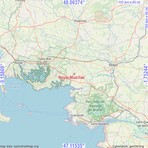
Noyal-Muzillac GPS coordinates[2]
47° 35' 30.084" North, 2° 27' 20.052" West
| Map corner | latitude | longitude |
|---|---|---|
| Upper-left | 48.06374°, | -3.15869° |
| Center: | 47.59169°, | -2.45557° |
| Lower-right: | 47.11535°, | -1.75244° |
| Map W x H: | 105.5×105.4 km | = 65.6×65.5mi |
| max Lat: | 51.07786° ⇑47.5% North |
| Noyal-Muzillac: | 47.59169° |
| min Lat: | ⇓52.5% South 41.3874° |
| min Long | Noyal-Muzillac | max Long |
| -5.08615° | -2.45557° | 9.52242° |
| W 3.9%⇐ | ⇒96.1% E |
Elevation
Elevation of Noyal-Muzillac is 51 m = 167 ft, and this is 142.7 m = 468 ft below average elevation for this country.
| Max E: |
2333 m = 7654 ft | 81.5% |
| Avg. | 193.7 m = 635 ft | |
| Noyal-Muzillac | 51 m = 167 ft | |
Min E: |
-1 m = -3 ft | 18.5% |
See also: France elevation on elevation.city.
Geographical zone
Noyal-Muzillac is located in North temperate zone (between Tropic of Cancer and the Arctic Circle). Distance of this North polar circle is 2109.5 km =1310.8 mi to North.| Distance of | km | miles | from Noyal-Muzillac |
|---|---|---|---|
| North Pole | 4715.4 | 2930 | to North |
| Arctic Circle | 2109.5 | 1310.8 | to North |
| Tropic Cancer | 2685.8 | 1668.9 | to South |
| Equator | 5291.7 | 3288.1 | to South |


Nearby cities:
15 places around Noyal-Muzillac: (largest is in red/bold)
• Ambon
8.6 km =5.3 mi,  240°
240°
• Arzal
10.3 km =6.4 mi,  144°
144°
• Berric
6.8 km =4.2 mi,  312°
312°
• Billiers
7.2 km =4.5 mi,  199°
199°
• Damgan
12.3 km =7.6 mi,  228°
228°
• La Trinité-Surzur
10.3 km =6.4 mi,  277°
277°
• Lauzach
7.1 km =4.4 mi,  290°
290°
• Le Guerno
3.7 km =2.3 mi,  104°
104°
• Limerzel
9 km =5.6 mi,  56°
56°
• Marzan
11.3 km =7 mi,  120°
120°
• Muzillac
4.5 km =2.8 mi, 204°
• Péaule
7.6 km =4.7 mi, 100°
• Pénestin
12.2 km =7.6 mi,  186°
186°
• Questembert
7.9 km =4.9 mi,  1°
1°
• Sulniac
12.6 km =7.8 mi,  316°
316°
Sources, notices
• [Note1] Compared only with cities in France existing in our database
• [Src1] Map data: © OpenStreetMap contributors (CC-BY-SA)
• [Src2] Other city data from geonames.org with taken over terms of usage.
• [Src3] Geographical zone / Annual Mean Temperature by Robert A. Rohde @ Wikipedia
