Berric geodata
Berric (Brittany) is a populated place; located in France in Europe/Paris (GMT+2) time zone. With population of 1,100 people, there are 8130 cities with bigger population in this country. Compared to other cities in France, 53.2% of cities are located further ↓South; 96.3% of cities are located further →East and 69.2% of cities have higher elevation than Berric. Note1
Administrative division(s):
- Level 1: Brittany
- Level 2: Morbihan
- Level 3: Arrondissement de Vannes
- Level 4: Berric


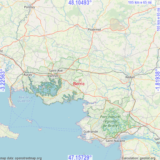
Berric GPS coordinates[2]
47° 37' 59.736" North, 2° 31' 21" West
| Map corner | latitude | longitude |
|---|---|---|
| Upper-left | 48.10493°, | -3.22563° |
| Center: | 47.63326°, | -2.5225° |
| Lower-right: | 47.15729°, | -1.81938° |
| Map W x H: | 105.4×105.4 km | = 65.5×65.5mi |
| max Lat: | 51.07786° ⇑46.8% North |
| Berric: | 47.63326° |
| min Lat: | ⇓53.2% South 41.3874° |
| min Long | Berric | max Long |
| -5.08615° | -2.5225° | 9.52242° |
| W 3.7%⇐ | ⇒96.3% E |
Elevation
Elevation of Berric is 80 m = 262 ft, and this is 113.7 m = 373 ft below average elevation for this country.
| Max E: |
2333 m = 7654 ft | 69.2% |
| Avg. | 193.7 m = 635 ft | |
| Berric | 80 m = 262 ft | |
Min E: |
-1 m = -3 ft | 30.8% |
See also: France elevation on elevation.city.
Geographical zone
Berric is located in North temperate zone (between Tropic of Cancer and the Arctic Circle). Distance of this North polar circle is 2104.9 km =1307.9 mi to North.| Distance of | km | miles | from Berric |
|---|---|---|---|
| North Pole | 4710.7 | 2927.1 | to North |
| Arctic Circle | 2104.9 | 1307.9 | to North |
| Tropic Cancer | 2690.4 | 1671.7 | to South |
| Equator | 5296.3 | 3291 | to South |


Nearby cities:
15 places around Berric: (largest is in red/bold)
• Ambon
9.2 km =5.7 mi,  195°
195°
• Billiers
11.7 km =7.3 mi,  167°
167°
• La Trinité-Surzur
6.1 km =3.8 mi,  238°
238°
• La Vraie-Croix
6.4 km =4 mi,  346°
346°
• Larré
8.8 km =5.5 mi,  3°
3°
• Lauzach
2.7 km =1.7 mi,  216°
216°
• Le Guerno
10.2 km =6.3 mi,  122°
122°
• Muzillac
9.3 km =5.8 mi,  160°
160°
• Noyal-Muzillac
6.8 km =4.2 mi,  132°
132°
• Noyalo
11.9 km =7.4 mi,  257°
257°
• Questembert
6.2 km =3.9 mi,  57°
57°
• Sulniac
5.8 km =3.6 mi,  320°
320°
• Surzur
10 km =6.2 mi,  232°
232°
• Theix
9.7 km =6 mi,  267°
267°
• Treffléan
8.6 km =5.3 mi,  308°
308°
Sources, notices
• [Note1] Compared only with cities in France existing in our database
• [Src1] Map data: © OpenStreetMap contributors (CC-BY-SA)
• [Src2] Other city data from geonames.org with taken over terms of usage.
• [Src3] Geographical zone / Annual Mean Temperature by Robert A. Rohde @ Wikipedia
