Launac geodata
Launac (Occitanie) is a populated place; located in France in Europe/Paris (GMT+2) time zone. With population of 1,163 people, there are 7751 cities with bigger population in this country. Compared to other cities in France, 89.8% of cities are located further ↑North; 67% of cities are located further →East and 62.1% of cities have lower elevation than Launac. Note1
Administrative division(s):
- Level 1: Occitanie
- Level 2: Haute-Garonne
- Level 3: Arrondissement de Toulouse
- Level 4: Launac


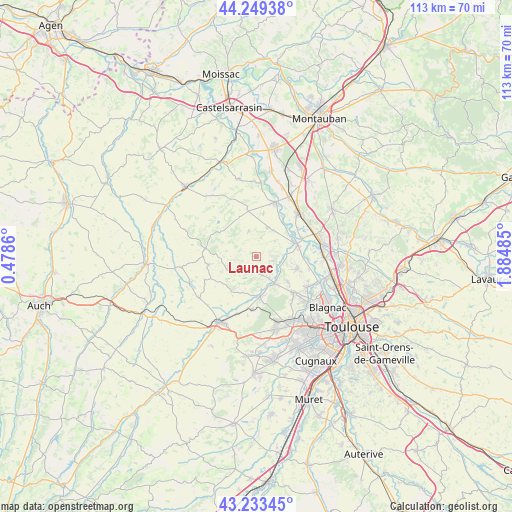
Launac GPS coordinates[2]
43° 44' 36.852" North, 1° 10' 54.192" East
| Map corner | latitude | longitude |
|---|---|---|
| Upper-left | 44.24938°, | 0.4786° |
| Center: | 43.74357°, | 1.18172° |
| Lower-right: | 43.23345°, | 1.88485° |
| Map W x H: | 113×113 km | = 70.2×70.2mi |
| max Lat: | 51.07786° ⇑89.8% North |
| Launac: | 43.74357° |
| min Lat: | ⇓10.2% South 41.3874° |
| min Long | Launac | max Long |
| -5.08615° | 1.18172° | 9.52242° |
| W 33%⇐ | ⇒67% E |
Elevation
Elevation of Launac is 180 m = 591 ft, and this is 13.7 m = 45 ft below average elevation for this country.
| Max E: |
2333 m = 7654 ft | 37.9% |
| Avg. | 193.7 m = 635 ft | |
| Launac | 180 m = 591 ft | |
Min E: |
-1 m = -3 ft | 62.1% |
See also: France elevation on elevation.city.
Geographical zone
Launac is located in North temperate zone (between Tropic of Cancer and the Arctic Circle). Distance of this Northern Tropic circle is 2257.9 km =1403 mi to South.| Distance of | km | miles | from Launac |
|---|---|---|---|
| North Pole | 5143.2 | 3195.8 | to North |
| Arctic Circle | 2537.3 | 1576.6 | to North |
| Tropic Cancer | 2257.9 | 1403 | to South |
| Equator | 4863.8 | 3022.2 | to South |


Nearby cities:
15 places around Launac: (largest is in red/bold)
• Aucamville
7 km =4.3 mi,  22°
22°
• Aussonne
13 km =8.1 mi,  122°
122°
• Cadours
10.7 km =6.6 mi,  260°
260°
• Daux
8.8 km =5.5 mi,  127°
127°
• Grenade
8.6 km =5.3 mi,  72°
72°
• Lasserre
11.7 km =7.3 mi,  185°
185°
• Le Castéra
8.5 km =5.3 mi,  202°
202°
• Lévignac
8.7 km =5.4 mi,  170°
170°
• Merville
9.5 km =5.9 mi,  103°
103°
• Mondonville
11.5 km =7.1 mi, 133°
• Montaigut-sur-Save
7.2 km =4.5 mi,  146°
146°
• Ondes
11 km =6.8 mi, 66°
• Savenès
9.9 km =6.2 mi,  7°
7°
• Thil
3.9 km =2.4 mi,  208°
208°
• Verdun-sur-Garonne
13 km =8.1 mi, 18°
Sources, notices
• [Note1] Compared only with cities in France existing in our database
• [Src1] Map data: © OpenStreetMap contributors (CC-BY-SA)
• [Src2] Other city data from geonames.org with taken over terms of usage.
• [Src3] Geographical zone / Annual Mean Temperature by Robert A. Rohde @ Wikipedia
