Ondes geodata
Ondes (Occitanie) is a populated place; located in France in Europe/Paris (GMT+2) time zone. With population of 1,020 people, there are 8683 cities with bigger population in this country. Compared to other cities in France, 89.3% of cities are located further ↑North; 65.5% of cities are located further →East and 57.3% of cities have higher elevation than Ondes. Note1
Administrative division(s):
- Level 1: Occitanie
- Level 2: Haute-Garonne
- Level 3: Arrondissement de Toulouse
- Level 4: Ondes


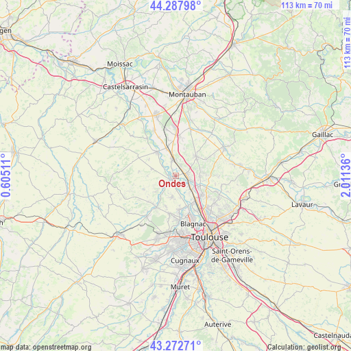
Ondes GPS coordinates[2]
43° 46' 57" North, 1° 18' 29.628" East
| Map corner | latitude | longitude |
|---|---|---|
| Upper-left | 44.28798°, | 0.60511° |
| Center: | 43.7825°, | 1.30823° |
| Lower-right: | 43.27271°, | 2.01136° |
| Map W x H: | 112.9×112.9 km | = 70.2×70.2mi |
| max Lat: | 51.07786° ⇑89.3% North |
| Ondes: | 43.7825° |
| min Lat: | ⇓10.7% South 41.3874° |
| min Long | Ondes | max Long |
| -5.08615° | 1.30823° | 9.52242° |
| W 34.5%⇐ | ⇒65.5% E |
Elevation
Elevation of Ondes is 110 m = 361 ft, and this is 83.7 m = 275 ft below average elevation for this country.
| Max E: |
2333 m = 7654 ft | 57.3% |
| Avg. | 193.7 m = 635 ft | |
| Ondes | 110 m = 361 ft | |
Min E: |
-1 m = -3 ft | 42.7% |
See also: France elevation on elevation.city.
Geographical zone
Ondes is located in North temperate zone (between Tropic of Cancer and the Arctic Circle). Distance of this Northern Tropic circle is 2262.2 km =1405.7 mi to South.| Distance of | km | miles | from Ondes |
|---|---|---|---|
| North Pole | 5138.9 | 3193.2 | to North |
| Arctic Circle | 2533 | 1573.9 | to North |
| Tropic Cancer | 2262.2 | 1405.7 | to South |
| Equator | 4868.2 | 3025 | to South |


Nearby cities:
15 places around Ondes: (largest is in red/bold)
• Aucamville
7.8 km =4.8 mi,  286°
286°
• Bouloc
7.8 km =4.8 mi,  90°
90°
• Canals
7.8 km =4.8 mi,  350°
350°
• Castelnau-d'Estrétefonds
4.1 km =2.5 mi, 88°
• Dieupentale
9.4 km =5.8 mi,  340°
340°
• Fronton
9.1 km =5.7 mi,  45°
45°
• Grenade
2.7 km =1.7 mi,  228°
228°
• Grisolles
5.3 km =3.3 mi, 349°
• Lespinasse
9.9 km =6.2 mi,  141°
141°
• Merville
6.6 km =4.1 mi,  188°
188°
• Pompignan
3.9 km =2.4 mi,  4°
4°
• Saint-Jory
6.8 km =4.2 mi,  132°
132°
• Saint-Sauveur
8.4 km =5.2 mi,  117°
117°
• Verdun-sur-Garonne
10 km =6.2 mi,  323°
323°
• Villeneuve-lès-Bouloc
9.3 km =5.8 mi,  100°
100°
Sources, notices
• [Note1] Compared only with cities in France existing in our database
• [Src1] Map data: © OpenStreetMap contributors (CC-BY-SA)
• [Src2] Other city data from geonames.org with taken over terms of usage.
• [Src3] Geographical zone / Annual Mean Temperature by Robert A. Rohde @ Wikipedia
