Verdun-sur-Garonne geodata
Verdun-sur-Garonne (Occitanie) is a populated place; located in France in Europe/Paris (GMT+2) time zone. With population of 3,269 people, there are 2985 cities with bigger population in this country. Compared to other cities in France, 88.6% of cities are located further ↑North; 66.3% of cities are located further →East and 59.7% of cities have higher elevation than Verdun-sur-Garonne. Note1
Administrative division(s):
- Level 1: Occitanie
- Level 2: Département du Tarn-et-Garonne
- Level 3: Arrondissement de Montauban
- Level 4: Verdun-sur-Garonne


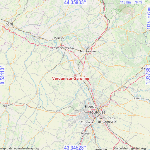
Verdun-sur-Garonne GPS coordinates[2]
43° 51' 16.056" North, 1° 14' 3.3" East
| Map corner | latitude | longitude |
|---|---|---|
| Upper-left | 44.35933°, | 0.53113° |
| Center: | 43.85446°, | 1.23425° |
| Lower-right: | 43.34528°, | 1.93738° |
| Map W x H: | 112.8×112.8 km | = 70.1×70.1mi |
| max Lat: | 51.07786° ⇑88.6% North |
| Verdun-sur-Garonne: | 43.85446° |
| min Lat: | ⇓11.4% South 41.3874° |
| min Long | Verdun-sur-Garo | max Long |
| -5.08615° | 1.23425° | 9.52242° |
| W 33.7%⇐ | ⇒66.3% E |
Elevation
Elevation of Verdun-sur-Garonne is 103 m = 338 ft, and this is 90.7 m = 298 ft below average elevation for this country.
| Max E: |
2333 m = 7654 ft | 59.7% |
| Avg. | 193.7 m = 635 ft | |
| Verdun-sur-Garonne | 103 m = 338 ft | |
Min E: |
-1 m = -3 ft | 40.3% |
See also: France elevation on elevation.city.
Geographical zone
Verdun-sur-Garonne is located in North temperate zone (between Tropic of Cancer and the Arctic Circle). Distance of this Northern Tropic circle is 2270.2 km =1410.6 mi to South.| Distance of | km | miles | from Verdun-sur-Garonne |
|---|---|---|---|
| North Pole | 5130.9 | 3188.2 | to North |
| Arctic Circle | 2525 | 1569 | to North |
| Tropic Cancer | 2270.2 | 1410.6 | to South |
| Equator | 4876.2 | 3029.9 | to South |


Nearby cities:
15 places around Verdun-sur-Garonne: (largest is in red/bold)
• Aucamville
6 km =3.7 mi,  195°
195°
• Bessens
3.1 km =1.9 mi,  30°
30°
• Bourret
11.1 km =6.9 mi,  331°
331°
• Campsas
8.7 km =5.4 mi,  58°
58°
• Canals
4.6 km =2.9 mi,  93°
93°
• Dieupentale
3 km =1.9 mi,  72°
72°
• Finhan
6.6 km =4.1 mi,  350°
350°
• Grenade
10.5 km =6.5 mi,  158°
158°
• Grisolles
5.7 km =3.5 mi,  119°
119°
• Mas-Grenier
5.1 km =3.2 mi,  323°
323°
• Montbartier
7.3 km =4.5 mi, 26°
• Ondes
10 km =6.2 mi,  143°
143°
• Pompignan
7.5 km =4.7 mi, 123°
• Saint-Sardos
9.5 km =5.9 mi,  301°
301°
• Savenès
3.8 km =2.4 mi,  228°
228°
Sources, notices
• [Note1] Compared only with cities in France existing in our database
• [Src1] Map data: © OpenStreetMap contributors (CC-BY-SA)
• [Src2] Other city data from geonames.org with taken over terms of usage.
• [Src3] Geographical zone / Annual Mean Temperature by Robert A. Rohde @ Wikipedia
