Lapeyrouse-Mornay geodata
Lapeyrouse-Mornay (Auvergne-Rhône-Alpes) is a populated place; located in France in Europe/Paris (GMT+2) time zone. With population of 858 people, there are 10006 cities with bigger population in this country. Compared to other cities in France, 76.1% of cities are located further ↑North; 77.6% of cities are located further ←West and 73.3% of cities have lower elevation than Lapeyrouse-Mornay. Note1
Administrative division(s):
- Level 1: Auvergne-Rhône-Alpes
- Level 2: Département de la Drôme
- Level 3: Arrondissement de Valence
- Level 4: Lapeyrouse-Mornay


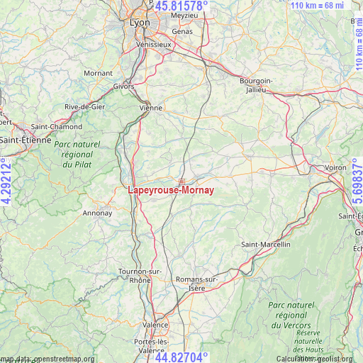
Lapeyrouse-Mornay GPS coordinates[2]
45° 19' 24.852" North, 4° 59' 42.864" East
| Map corner | latitude | longitude |
|---|---|---|
| Upper-left | 45.81578°, | 4.29212° |
| Center: | 45.32357°, | 4.99524° |
| Lower-right: | 44.82704°, | 5.69837° |
| Map W x H: | 109.9×109.9 km | = 68.3×68.3mi |
| max Lat: | 51.07786° ⇑76.1% North |
| Lapeyrouse-Mornay: | 45.32357° |
| min Lat: | ⇓23.9% South 41.3874° |
| min Long | Lapeyrouse-Morn | max Long |
| -5.08615° | 4.99524° | 9.52242° |
| W 77.6%⇐ | ⇒22.4% E |
Elevation
Elevation of Lapeyrouse-Mornay is 238 m = 781 ft, and this is 44.3 m = 145 ft above average elevation for this country.
| Max E: |
2333 m = 7654 ft | 26.7% |
| Lapeyrouse-Mornay | 238 m 781 ft | |
| Avg. | 193.7 m = 635 ft | |
Min E: |
-1 m = -3 ft | 73.3% |
See also: France elevation on elevation.city.
Geographical zone
Lapeyrouse-Mornay is located in North temperate zone (between Tropic of Cancer and the Arctic Circle). Distance of this North polar circle is 2361.7 km =1467.5 mi to North.| Distance of | km | miles | from Lapeyrouse-Mornay |
|---|---|---|---|
| North Pole | 4967.6 | 3086.7 | to North |
| Arctic Circle | 2361.7 | 1467.5 | to North |
| Tropic Cancer | 2433.6 | 1512.2 | to South |
| Equator | 5039.5 | 3131.4 | to South |


Nearby cities:
15 places around Lapeyrouse-Mornay: (largest is in red/bold)
• Beaurepaire
4.4 km =2.7 mi,  70°
70°
• Bellegarde-Poussieu
6.7 km =4.2 mi,  330°
330°
• Bougé-Chambalud
7.5 km =4.7 mi,  275°
275°
• Hauterives
7.8 km =4.8 mi,  166°
166°
• Jarcieu
4.2 km =2.6 mi,  286°
286°
• Lens-Lestang
5.1 km =3.2 mi,  132°
132°
• Manthes
2.5 km =1.6 mi,  149°
149°
• Marcollin
7 km =4.3 mi,  106°
106°
• Moissieu-sur-Dolon
7 km =4.3 mi,  356°
356°
• Moras-en-Valloire
3.6 km =2.2 mi, 174°
• Pact
3.2 km =2 mi,  351°
351°
• Revel
7.2 km =4.5 mi,  24°
24°
• Saint-Sorlin-en-Valloire
5.4 km =3.4 mi,  222°
222°
• Sonnay
8 km =5 mi,  298°
298°
• Épinouze
5.4 km =3.4 mi,  253°
253°
Sources, notices
• [Note1] Compared only with cities in France existing in our database
• [Src1] Map data: © OpenStreetMap contributors (CC-BY-SA)
• [Src2] Other city data from geonames.org with taken over terms of usage.
• [Src3] Geographical zone / Annual Mean Temperature by Robert A. Rohde @ Wikipedia
