Hauterives geodata
Hauterives (Auvergne-Rhône-Alpes) is a populated place; located in France in Europe/Paris (GMT+2) time zone. With population of 1,438 people, there are 6441 cities with bigger population in this country. Compared to other cities in France, 76.8% of cities are located further ↑North; 77.9% of cities are located further ←West and 81% of cities have lower elevation than Hauterives. Note1
Administrative division(s):
- Level 1: Auvergne-Rhône-Alpes
- Level 2: Département de la Drôme
- Level 3: Arrondissement de Valence
- Level 4: Hauterives


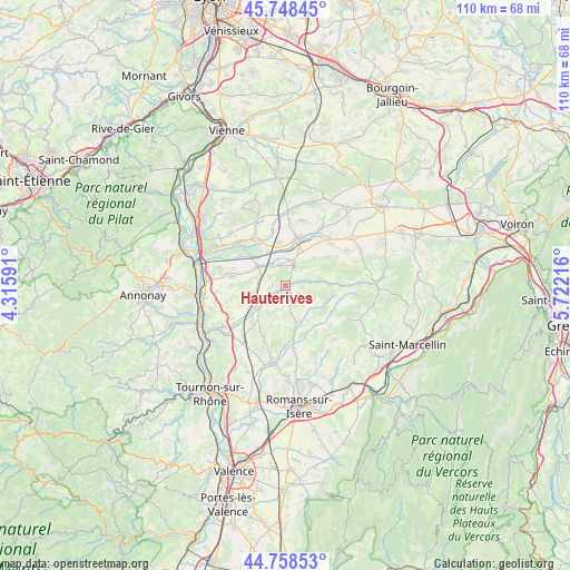
Hauterives GPS coordinates[2]
45° 15' 20.34" North, 5° 1' 8.544" East
| Map corner | latitude | longitude |
|---|---|---|
| Upper-left | 45.74845°, | 4.31591° |
| Center: | 45.25565°, | 5.01904° |
| Lower-right: | 44.75853°, | 5.72216° |
| Map W x H: | 110.1×110.1 km | = 68.4×68.4mi |
| max Lat: | 51.07786° ⇑76.8% North |
| Hauterives: | 45.25565° |
| min Lat: | ⇓23.2% South 41.3874° |
| min Long | Hauterives | max Long |
| -5.08615° | 5.01904° | 9.52242° |
| W 77.9%⇐ | ⇒22.1% E |
Elevation
Elevation of Hauterives is 300 m = 984 ft, and this is 106.3 m = 349 ft above average elevation for this country.
| Max E: |
2333 m = 7654 ft | 19% |
| Hauterives | 300 m 984 ft | |
| Avg. | 193.7 m = 635 ft | |
Min E: |
-1 m = -3 ft | 81% |
See also: France elevation on elevation.city.
Geographical zone
Hauterives is located in North temperate zone (between Tropic of Cancer and the Arctic Circle). Distance of this North polar circle is 2369.2 km =1472.2 mi to North.| Distance of | km | miles | from Hauterives |
|---|---|---|---|
| North Pole | 4975.1 | 3091.4 | to North |
| Arctic Circle | 2369.2 | 1472.2 | to North |
| Tropic Cancer | 2426 | 1507.4 | to South |
| Equator | 5032 | 3126.7 | to South |


Nearby cities:
15 places around Hauterives: (largest is in red/bold)
• Anneyron
10.6 km =6.6 mi,  280°
280°
• Beaurepaire
9.3 km =5.8 mi,  14°
14°
• Châteauneuf-de-Galaure
5.6 km =3.5 mi,  239°
239°
• Crépol
9.8 km =6.1 mi,  154°
154°
• Jarcieu
10.5 km =6.5 mi,  326°
326°
• La Motte-de-Galaure
10.9 km =6.8 mi,  233°
233°
• Lapeyrouse-Mornay
7.8 km =4.8 mi,  346°
346°
• Le Grand-Serre
6.8 km =4.2 mi,  77°
77°
• Lens-Lestang
4.6 km =2.9 mi,  24°
24°
• Manthes
5.5 km =3.4 mi, 353°
• Marcollin
7.4 km =4.6 mi,  41°
41°
• Moras-en-Valloire
4.2 km =2.6 mi,  338°
338°
• Pact
10.9 km =6.8 mi, 347°
• Saint-Sorlin-en-Valloire
6.5 km =4 mi,  303°
303°
• Épinouze
9.3 km =5.8 mi,  310°
310°
Sources, notices
• [Note1] Compared only with cities in France existing in our database
• [Src1] Map data: © OpenStreetMap contributors (CC-BY-SA)
• [Src2] Other city data from geonames.org with taken over terms of usage.
• [Src3] Geographical zone / Annual Mean Temperature by Robert A. Rohde @ Wikipedia
