Épinouze geodata
Épinouze (Auvergne-Rhône-Alpes) is a populated place; located in France in Europe/Paris (GMT+2) time zone. With population of 1,173 people, there are 7685 cities with bigger population in this country. Compared to other cities in France, 76.2% of cities are located further ↑North; 76.8% of cities are located further ←West and 71.7% of cities have lower elevation than Épinouze. Note1
Administrative division(s):
- Level 1: Auvergne-Rhône-Alpes
- Level 2: Département de la Drôme
- Level 3: Arrondissement de Valence
- Level 4: Épinouze


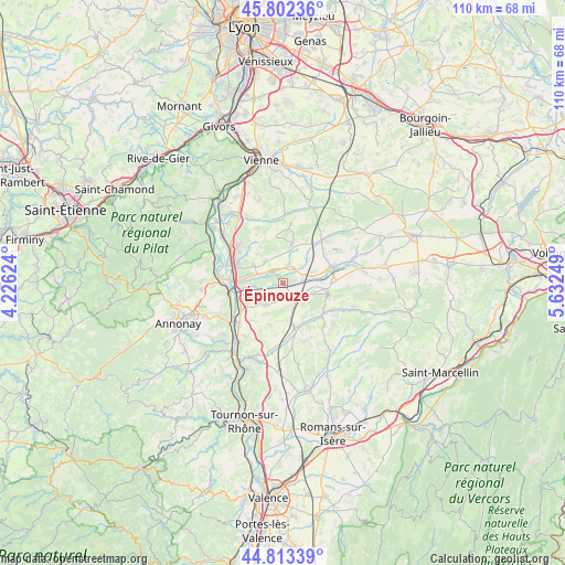
Épinouze GPS coordinates[2]
45° 18' 36.108" North, 4° 55' 45.696" East
| Map corner | latitude | longitude |
|---|---|---|
| Upper-left | 45.80236°, | 4.22624° |
| Center: | 45.31003°, | 4.92936° |
| Lower-right: | 44.81339°, | 5.63249° |
| Map W x H: | 110×110 km | = 68.4×68.4mi |
| max Lat: | 51.07786° ⇑76.2% North |
| Épinouze: | 45.31003° |
| min Lat: | ⇓23.8% South 41.3874° |
| min Long | Épinouze | max Long |
| -5.08615° | 4.92936° | 9.52242° |
| W 76.8%⇐ | ⇒23.2% E |
Elevation
Elevation of Épinouze is 228 m = 748 ft, and this is 34.3 m = 113 ft above average elevation for this country.
| Max E: |
2333 m = 7654 ft | 28.3% |
| Épinouze | 228 m 748 ft | |
| Avg. | 193.7 m = 635 ft | |
Min E: |
-1 m = -3 ft | 71.7% |
See also: France elevation on elevation.city.
Geographical zone
Épinouze is located in North temperate zone (between Tropic of Cancer and the Arctic Circle). Distance of this North polar circle is 2363.2 km =1468.4 mi to North.| Distance of | km | miles | from Épinouze |
|---|---|---|---|
| North Pole | 4969.1 | 3087.7 | to North |
| Arctic Circle | 2363.2 | 1468.4 | to North |
| Tropic Cancer | 2432.1 | 1511.2 | to South |
| Equator | 5038 | 3130.5 | to South |


Nearby cities:
15 places around Épinouze: (largest is in red/bold)
• Agnin
6.8 km =4.2 mi,  299°
299°
• Anjou
5.6 km =3.5 mi,  320°
320°
• Anneyron
5.4 km =3.4 mi,  218°
218°
• Bellegarde-Poussieu
7.5 km =4.7 mi,  13°
13°
• Bougé-Chambalud
3.3 km =2.1 mi,  314°
314°
• Chanas
8.7 km =5.4 mi,  276°
276°
• Châteauneuf-de-Galaure
9.2 km =5.7 mi,  166°
166°
• Jarcieu
2.9 km =1.8 mi,  23°
23°
• Lapeyrouse-Mornay
5.4 km =3.4 mi,  73°
73°
• Lens-Lestang
9.1 km =5.7 mi,  101°
101°
• Manthes
6.4 km =4 mi, 95°
• Moras-en-Valloire
5.9 km =3.7 mi,  110°
110°
• Pact
6.6 km =4.1 mi,  45°
45°
• Saint-Sorlin-en-Valloire
2.9 km =1.8 mi,  148°
148°
• Sonnay
5.7 km =3.5 mi,  340°
340°
Sources, notices
• [Note1] Compared only with cities in France existing in our database
• [Src1] Map data: © OpenStreetMap contributors (CC-BY-SA)
• [Src2] Other city data from geonames.org with taken over terms of usage.
• [Src3] Geographical zone / Annual Mean Temperature by Robert A. Rohde @ Wikipedia
