Lanvéoc geodata
Lanvéoc (Brittany) is a populated place; located in France in Europe/Paris (GMT+2) time zone. With population of 2,282 people, there are 4226 cities with bigger population in this country. Compared to other cities in France, 64.4% of cities are located further ↓South; 99.7% of cities are located further →East and 79% of cities have higher elevation than Lanvéoc. Note1
Administrative division(s):
- Level 1: Brittany
- Level 2: Département du Finistère
- Level 3: Arrondissement de Châteaulin
- Level 4: Lanvéoc


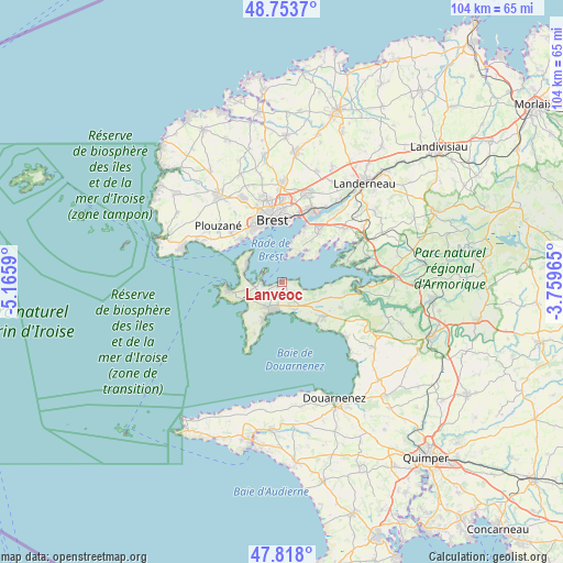
Lanvéoc GPS coordinates[2]
48° 17' 16.764" North, 4° 27' 45.972" West
| Map corner | latitude | longitude |
|---|---|---|
| Upper-left | 48.7537°, | -5.1659° |
| Center: | 48.28799°, | -4.46277° |
| Lower-right: | 47.818°, | -3.75965° |
| Map W x H: | 104×104 km | = 64.6×64.6mi |
| max Lat: | 51.07786° ⇑35.6% North |
| Lanvéoc: | 48.28799° |
| min Lat: | ⇓64.4% South 41.3874° |
| min Long | Lanvéoc | max Long |
| -5.08615° | -4.46277° | 9.52242° |
| W 0.3%⇐ | ⇒99.7% E |
Elevation
Elevation of Lanvéoc is 57 m = 187 ft, and this is 136.7 m = 448 ft below average elevation for this country.
| Max E: |
2333 m = 7654 ft | 79% |
| Avg. | 193.7 m = 635 ft | |
| Lanvéoc | 57 m = 187 ft | |
Min E: |
-1 m = -3 ft | 21% |
See also: France elevation on elevation.city.
Geographical zone
Lanvéoc is located in North temperate zone (between Tropic of Cancer and the Arctic Circle). Distance of this North polar circle is 2032.1 km =1262.7 mi to North.| Distance of | km | miles | from Lanvéoc |
|---|---|---|---|
| North Pole | 4637.9 | 2881.9 | to North |
| Arctic Circle | 2032.1 | 1262.7 | to North |
| Tropic Cancer | 2763.2 | 1717 | to South |
| Equator | 5369.1 | 3336.2 | to South |


Nearby cities:
15 places around Lanvéoc: (largest is in red/bold)
• Argol
11.8 km =7.3 mi,  113°
113°
• Bohars
16.2 km =10.1 mi,  346°
346°
• Brest
11.5 km =7.1 mi, 351°
• Camaret-sur-Mer
10 km =6.2 mi,  261°
261°
• Crozon
5 km =3.1 mi,  203°
203°
• Guilers
16.8 km =10.4 mi,  335°
335°
• Hôpital-Camfrout
17 km =10.6 mi,  74°
74°
• Le Relecq-Kerhuon
14.2 km =8.8 mi,  21°
21°
• Logonna-Daoulas
12.9 km =8 mi, 72°
• Loperhet
15.3 km =9.5 mi,  49°
49°
• Plougastel-Daoulas
11.3 km =7 mi,  39°
39°
• Plouzané
15.5 km =9.6 mi,  312°
312°
• Roscanvel
7.1 km =4.4 mi,  295°
295°
• Saint-Nic
16.5 km =10.3 mi,  126°
126°
• Telgruc-sur-Mer
10.3 km =6.4 mi, 126°
Sources, notices
• [Note1] Compared only with cities in France existing in our database
• [Src1] Map data: © OpenStreetMap contributors (CC-BY-SA)
• [Src2] Other city data from geonames.org with taken over terms of usage.
• [Src3] Geographical zone / Annual Mean Temperature by Robert A. Rohde @ Wikipedia
