Argol geodata
Argol (Brittany) is a populated place; located in France in Europe/Paris (GMT+2) time zone. With population of 842 people, there are 10164 cities with bigger population in this country. Compared to other cities in France, 63.6% of cities are located further ↓South; 99.5% of cities are located further →East and 71.9% of cities have higher elevation than Argol. Note1
Administrative division(s):
- Level 1: Brittany
- Level 2: Département du Finistère
- Level 3: Arrondissement de Châteaulin
- Level 4: Argol


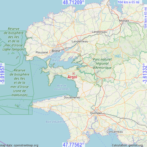
Argol GPS coordinates[2]
48° 14' 45.6" North, 4° 18' 59.184" West
| Map corner | latitude | longitude |
|---|---|---|
| Upper-left | 48.71209°, | -5.01957° |
| Center: | 48.246°, | -4.31644° |
| Lower-right: | 47.77562°, | -3.61332° |
| Map W x H: | 104.1×104.1 km | = 64.7×64.7mi |
| max Lat: | 51.07786° ⇑36.4% North |
| Argol: | 48.246° |
| min Lat: | ⇓63.6% South 41.3874° |
| min Long | Argol | max Long |
| -5.08615° | -4.31644° | 9.52242° |
| W 0.5%⇐ | ⇒99.5% E |
Elevation
Elevation of Argol is 74 m = 243 ft, and this is 119.7 m = 393 ft below average elevation for this country.
| Max E: |
2333 m = 7654 ft | 71.9% |
| Avg. | 193.7 m = 635 ft | |
| Argol | 74 m = 243 ft | |
Min E: |
-1 m = -3 ft | 28.1% |
See also: France elevation on elevation.city.
Geographical zone
Argol is located in North temperate zone (between Tropic of Cancer and the Arctic Circle). Distance of this North polar circle is 2036.7 km =1265.5 mi to North.| Distance of | km | miles | from Argol |
|---|---|---|---|
| North Pole | 4642.6 | 2884.8 | to North |
| Arctic Circle | 2036.7 | 1265.5 | to North |
| Tropic Cancer | 2758.5 | 1714.1 | to South |
| Equator | 5364.5 | 3333.3 | to South |


Nearby cities:
15 places around Argol: (largest is in red/bold)
• Crozon
12.8 km =8 mi,  270°
270°
• Daoulas
13.4 km =8.3 mi,  18°
18°
• Dinéault
11.7 km =7.3 mi,  104°
104°
• Hanvec
14.7 km =9.1 mi,  52°
52°
• Hôpital-Camfrout
10.7 km =6.6 mi,  31°
31°
• Irvillac
15.8 km =9.8 mi, 29°
• Lanvéoc
11.8 km =7.3 mi,  293°
293°
• Le Faou
11.5 km =7.1 mi,  61°
61°
• Logonna-Daoulas
8.7 km =5.4 mi,  9°
9°
• Loperhet
14.6 km =9.1 mi,  3°
3°
• Plomodiern
9.3 km =5.8 mi,  138°
138°
• Plougastel-Daoulas
13.9 km =8.6 mi,  344°
344°
• Rosnoën
8.9 km =5.5 mi,  75°
75°
• Saint-Nic
5.7 km =3.5 mi,  154°
154°
• Telgruc-sur-Mer
2.9 km =1.8 mi,  240°
240°
Sources, notices
• [Note1] Compared only with cities in France existing in our database
• [Src1] Map data: © OpenStreetMap contributors (CC-BY-SA)
• [Src2] Other city data from geonames.org with taken over terms of usage.
• [Src3] Geographical zone / Annual Mean Temperature by Robert A. Rohde @ Wikipedia
