La Motte-Saint-Martin geodata
La Motte-Saint-Martin (Auvergne-Rhône-Alpes) is a populated place; located in France in Europe/Paris (GMT+2) time zone. With population of 1,647 people, there are 5674 cities with bigger population in this country. Compared to other cities in France, 80% of cities are located further ↑North; 84.5% of cities are located further ←West and 97.1% of cities have lower elevation than La Motte-Saint-Martin. Note1
Administrative division(s):
- Level 1: Auvergne-Rhône-Alpes
- Level 2: Département de l'Isère
- Level 3: Arrondissement de Grenoble
- Level 4: La Motte-Saint-Martin
Current local time in La Motte-Saint-Martin:
02:43 PM, SaturdayDifference from your time zone: hours


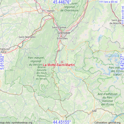
La Motte-Saint-Martin GPS coordinates[2]
44° 57' 4.716" North, 5° 43' 5.304" East
| Map corner | latitude | longitude |
|---|---|---|
| Upper-left | 45.44676°, | 5.01502° |
| Center: | 44.95131°, | 5.71814° |
| Lower-right: | 44.45155°, | 6.42127° |
| Map W x H: | 110.7×110.7 km | = 68.8×68.8mi |
| max Lat: | 51.07786° ⇑80% North |
| La Motte-Saint-Martin: | 44.95131° |
| min Lat: | ⇓20% South 41.3874° |
| min Long | La Motte-Saint- | max Long |
| -5.08615° | 5.71814° | 9.52242° |
| W 84.5%⇐ | ⇒15.5% E |
Elevation
Elevation of La Motte-Saint-Martin is 730 m = 2395 ft, and this is 536.3 m = 1760 ft above average elevation for this country.
| Max E: |
2333 m = 7654 ft | 2.9% |
| La Motte-Saint-Martin | 730 m 2395 ft | |
| Avg. | 193.7 m = 635 ft | |
Min E: |
-1 m = -3 ft | 97.1% |
See also: France elevation on elevation.city.
Geographical zone
La Motte-Saint-Martin is located in North temperate zone (between Tropic of Cancer and the Arctic Circle). Distance of this Northern Tropic circle is 2392.2 km =1486.4 mi to South.| Distance of | km | miles | from La Motte-Saint-Martin |
|---|---|---|---|
| North Pole | 5008.9 | 3112.4 | to North |
| Arctic Circle | 2403.1 | 1493.2 | to North |
| Tropic Cancer | 2392.2 | 1486.4 | to South |
| Equator | 4998.1 | 3105.7 | to South |


Nearby cities:
15 places around La Motte-Saint-Martin: (largest is in red/bold)
• Champ-sur-Drac
13.2 km =8.2 mi,  4°
4°
• La Motte-d’Aveillans
2.3 km =1.4 mi,  64°
64°
• La Mure
7.9 km =4.9 mi,  134°
134°
• Le Gua
10.8 km =6.7 mi,  312°
312°
• Monestier-de-Clermont
7.5 km =4.7 mi,  240°
240°
• Notre-Dame-de-Mésage
12.8 km =8 mi,  14°
14°
• Pierre-Châtel
4.5 km =2.8 mi,  81°
81°
• Saint-Barthélemy
8.8 km =5.5 mi, 307°
• Saint-Barthélemy-de-Séchilienne
14 km =8.7 mi,  38°
38°
• Saint-Georges-de-Commiers
10.5 km =6.5 mi,  354°
354°
• Saint-Honoré
7.8 km =4.8 mi,  97°
97°
• Saint-Pierre-de-Mésage
12 km =7.5 mi,  28°
28°
• Sinard
4.8 km =3 mi,  261°
261°
• Vif
12.2 km =7.6 mi,  342°
342°
• Vizille
14.7 km =9.1 mi,  16°
16°
Sources, notices
• [Note1] Compared only with cities in France existing in our database
• [Src1] Map data: © OpenStreetMap contributors (CC-BY-SA)
• [Src2] Other city data from geonames.org with taken over terms of usage.
• [Src3] Geographical zone / Annual Mean Temperature by Robert A. Rohde @ Wikipedia
