La Motte-d’Aveillans geodata
La Motte-d’Aveillans (Auvergne-Rhône-Alpes) is a populated place; located in France in Europe/Paris (GMT+2) time zone. With population of 1,810 people, there are 5233 cities with bigger population in this country. Compared to other cities in France, 79.9% of cities are located further ↑North; 84.6% of cities are located further ←West and 98.5% of cities have lower elevation than La Motte-d’Aveillans. Note1
Administrative division(s):
- Level 1: Auvergne-Rhône-Alpes
- Level 2: Département de l'Isère
- Level 3: Arrondissement de Grenoble
- Level 4: La Motte-d'Aveillans


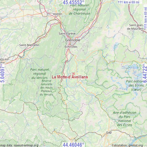
La Motte-d’Aveillans GPS coordinates[2]
44° 57' 36.54" North, 5° 44' 38.724" East
| Map corner | latitude | longitude |
|---|---|---|
| Upper-left | 45.45552°, | 5.04097° |
| Center: | 44.96015°, | 5.74409° |
| Lower-right: | 44.46046°, | 6.44722° |
| Map W x H: | 110.6×110.6 km | = 68.7×68.7mi |
| max Lat: | 51.07786° ⇑79.9% North |
| La Motte-d’Aveillans: | 44.96015° |
| min Lat: | ⇓20.1% South 41.3874° |
| min Long | La Motte-d’Av | max Long |
| -5.08615° | 5.74409° | 9.52242° |
| W 84.6%⇐ | ⇒15.4% E |
Elevation
Elevation of La Motte-d’Aveillans is 886 m = 2907 ft, and this is 692.3 m = 2271 ft above average elevation for this country.
| Max E: |
2333 m = 7654 ft | 1.5% |
| La Motte-d’Aveillans | 886 m 2907 ft | |
| Avg. | 193.7 m = 635 ft | |
Min E: |
-1 m = -3 ft | 98.5% |
See also: France elevation on elevation.city.
Geographical zone
La Motte-d’Aveillans is located in North temperate zone (between Tropic of Cancer and the Arctic Circle). Distance of this Northern Tropic circle is 2393.2 km =1487.1 mi to South.| Distance of | km | miles | from La Motte-d’Aveillans |
|---|---|---|---|
| North Pole | 5008 | 3111.8 | to North |
| Arctic Circle | 2402.1 | 1492.6 | to North |
| Tropic Cancer | 2393.2 | 1487.1 | to South |
| Equator | 4999.1 | 3106.3 | to South |


Nearby cities:
15 places around La Motte-d’Aveillans: (largest is in red/bold)
• Champ-sur-Drac
12.2 km =7.6 mi,  355°
355°
• La Motte-Saint-Martin
2.3 km =1.4 mi,  244°
244°
• La Mure
7.4 km =4.6 mi,  151°
151°
• Le Gua
11.8 km =7.3 mi,  302°
302°
• Monestier-de-Clermont
9.8 km =6.1 mi, 241°
• Notre-Dame-de-Mésage
11.4 km =7.1 mi,  5°
5°
• Pierre-Châtel
2.4 km =1.5 mi,  97°
97°
• Saint-Barthélemy
10 km =6.2 mi, 296°
• Saint-Barthélemy-de-Séchilienne
12 km =7.5 mi,  34°
34°
• Saint-Georges-de-Commiers
9.9 km =6.2 mi,  342°
342°
• Saint-Honoré
6 km =3.7 mi,  108°
108°
• Saint-Pierre-de-Mésage
10.3 km =6.4 mi,  20°
20°
• Sinard
7 km =4.3 mi,  255°
255°
• Séchilienne
12.9 km =8 mi, 32°
• Vif
12.1 km =7.5 mi,  332°
332°
Sources, notices
• [Note1] Compared only with cities in France existing in our database
• [Src1] Map data: © OpenStreetMap contributors (CC-BY-SA)
• [Src2] Other city data from geonames.org with taken over terms of usage.
• [Src3] Geographical zone / Annual Mean Temperature by Robert A. Rohde @ Wikipedia
