Lamanon geodata
Lamanon (Provence-Alpes-Côte d'Azur) is a populated place; located in France in Europe/Paris (GMT+2) time zone. With population of 1,815 people, there are 5224 cities with bigger population in this country. Compared to other cities in France, 90.4% of cities are located further ↑North; 78.6% of cities are located further ←West and 57.3% of cities have higher elevation than Lamanon. Note1
Administrative division(s):
- Level 1: Provence-Alpes-Côte d'Azur
- Level 2: Département des Bouches-du-Rhône
- Level 3: Aix-en-Provence
- Level 4: Lamanon


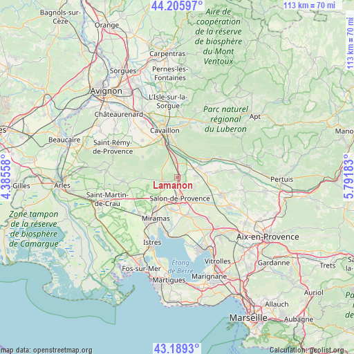
Lamanon GPS coordinates[2]
43° 41' 59.244" North, 5° 5' 19.356" East
| Map corner | latitude | longitude |
|---|---|---|
| Upper-left | 44.20597°, | 4.38558° |
| Center: | 43.69979°, | 5.08871° |
| Lower-right: | 43.1893°, | 5.79183° |
| Map W x H: | 113×113 km | = 70.2×70.2mi |
| max Lat: | 51.07786° ⇑90.4% North |
| Lamanon: | 43.69979° |
| min Lat: | ⇓9.6% South 41.3874° |
| min Long | Lamanon | max Long |
| -5.08615° | 5.08871° | 9.52242° |
| W 78.6%⇐ | ⇒21.4% E |
Elevation
Elevation of Lamanon is 110 m = 361 ft, and this is 83.7 m = 275 ft below average elevation for this country.
| Max E: |
2333 m = 7654 ft | 57.3% |
| Avg. | 193.7 m = 635 ft | |
| Lamanon | 110 m = 361 ft | |
Min E: |
-1 m = -3 ft | 42.7% |
See also: France elevation on elevation.city.
Geographical zone
Lamanon is located in North temperate zone (between Tropic of Cancer and the Arctic Circle). Distance of this Northern Tropic circle is 2253 km =1399.9 mi to South.| Distance of | km | miles | from Lamanon |
|---|---|---|---|
| North Pole | 5148.1 | 3198.9 | to North |
| Arctic Circle | 2542.2 | 1579.6 | to North |
| Tropic Cancer | 2253 | 1399.9 | to South |
| Equator | 4859 | 3019.2 | to South |


Nearby cities:
15 places around Lamanon: (largest is in red/bold)
• Alleins
5.9 km =3.7 mi,  85°
85°
• Aureille
11.4 km =7.1 mi,  274°
274°
• Aurons
6.7 km =4.2 mi,  124°
124°
• Cheval-Blanc
11.5 km =7.1 mi,  349°
349°
• Eyguières
4.6 km =2.9 mi,  263°
263°
• Grans
10.3 km =6.4 mi,  191°
191°
• La Barben
10.5 km =6.5 mi,  137°
137°
• Lançon-Provence
12.3 km =7.6 mi,  165°
165°
• Mallemort
8.1 km =5 mi,  64°
64°
• Mérindol
11.1 km =6.9 mi, 56°
• Orgon
10.9 km =6.8 mi,  338°
338°
• Pélissanne
9 km =5.6 mi,  145°
145°
• Salon-de-Provence
6.4 km =4 mi,  175°
175°
• Sénas
5 km =3.1 mi, 350°
• Vernègues
6.8 km =4.2 mi,  103°
103°
Sources, notices
• [Note1] Compared only with cities in France existing in our database
• [Src1] Map data: © OpenStreetMap contributors (CC-BY-SA)
• [Src2] Other city data from geonames.org with taken over terms of usage.
• [Src3] Geographical zone / Annual Mean Temperature by Robert A. Rohde @ Wikipedia
