Lacroix-Barrez geodata
Lacroix-Barrez (Occitanie) is a populated place; located in France in Europe/Paris (GMT+2) time zone. With population of 573 people, there are 13785 cities with bigger population in this country. Compared to other cities in France, 81.5% of cities are located further ↑North; 52.6% of cities are located further ←West and 97.5% of cities have lower elevation than Lacroix-Barrez. Note1
Administrative division(s):
- Level 1: Occitanie
- Level 2: Département de l'Aveyron
- Level 3: Arrondissement de Rodez
- Level 4: Lacroix-Barrez


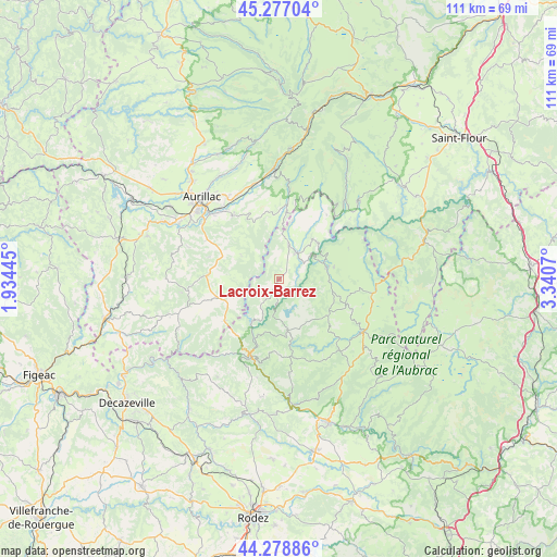
Lacroix-Barrez GPS coordinates[2]
44° 46' 48.396" North, 2° 38' 15.288" East
| Map corner | latitude | longitude |
|---|---|---|
| Upper-left | 45.27704°, | 1.93445° |
| Center: | 44.78011°, | 2.63758° |
| Lower-right: | 44.27886°, | 3.3407° |
| Map W x H: | 111×111 km | = 69×69mi |
| max Lat: | 51.07786° ⇑81.5% North |
| Lacroix-Barrez: | 44.78011° |
| min Lat: | ⇓18.5% South 41.3874° |
| min Long | Lacroix-Barrez | max Long |
| -5.08615° | 2.63758° | 9.52242° |
| W 52.6%⇐ | ⇒47.4% E |
Elevation
Elevation of Lacroix-Barrez is 770 m = 2526 ft, and this is 576.3 m = 1891 ft above average elevation for this country.
| Max E: |
2333 m = 7654 ft | 2.5% |
| Lacroix-Barrez | 770 m 2526 ft | |
| Avg. | 193.7 m = 635 ft | |
Min E: |
-1 m = -3 ft | 97.5% |
See also: France elevation on elevation.city.
Geographical zone
Lacroix-Barrez is located in North temperate zone (between Tropic of Cancer and the Arctic Circle). Distance of this Northern Tropic circle is 2373.2 km =1474.6 mi to South.| Distance of | km | miles | from Lacroix-Barrez |
|---|---|---|---|
| North Pole | 5028 | 3124.3 | to North |
| Arctic Circle | 2422.1 | 1505 | to North |
| Tropic Cancer | 2373.2 | 1474.6 | to South |
| Equator | 4979.1 | 3093.9 | to South |


Nearby cities:
15 places around Lacroix-Barrez: (largest is in red/bold)
• Arpajon-sur-Cère
19.8 km =12.3 mi,  313°
313°
• Brommat
6.6 km =4.1 mi,  34°
34°
• Entraygues-sur-Truyère
15.9 km =9.9 mi,  200°
200°
• Giou-de-Mamou
19.5 km =12.1 mi,  329°
329°
• Lafeuillade-en-Vézie
14 km =8.7 mi,  274°
274°
• Laguiole
19.6 km =12.2 mi,  122°
122°
• Le Nayrac
18.7 km =11.6 mi,  173°
173°
• Montpeyroux
21.3 km =13.2 mi,  136°
136°
• Montsalvy
13.5 km =8.4 mi,  233°
233°
• Mur-de-Barrez
7.3 km =4.5 mi,  14°
14°
• Polminhac
19.7 km =12.2 mi,  346°
346°
• Prunet
14.5 km =9 mi,  288°
288°
• Saint-Amans-des-Cots
10.6 km =6.6 mi, 169°
• Sainte-Geneviève-sur-Argence
9.9 km =6.2 mi,  75°
75°
• Taussac
5.4 km =3.4 mi,  3°
3°
Sources, notices
• [Note1] Compared only with cities in France existing in our database
• [Src1] Map data: © OpenStreetMap contributors (CC-BY-SA)
• [Src2] Other city data from geonames.org with taken over terms of usage.
• [Src3] Geographical zone / Annual Mean Temperature by Robert A. Rohde @ Wikipedia
