La Feuillade geodata
La Feuillade (Nouvelle-Aquitaine) is a populated place; located in France in Europe/Paris (GMT+2) time zone. With population of 724 people, there are 11480 cities with bigger population in this country. Compared to other cities in France, 73.1% of cities are located further ↑North; 54.9% of cities are located further →East and 97.7% of cities have lower elevation than La Feuillade. Note1
Administrative division(s):
- Level 1: Nouvelle-Aquitaine
- Level 2: Département de la Corrèze
- Level 3: Ussel
- Level 4: Meymac


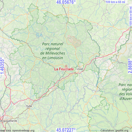
La Feuillade GPS coordinates[2]
45° 34' 0.012" North, 2° 10' 0.012" East
| Map corner | latitude | longitude |
|---|---|---|
| Upper-left | 46.05676°, | 1.46355° |
| Center: | 45.56667°, | 2.16667° |
| Lower-right: | 45.07227°, | 2.8698° |
| Map W x H: | 109.5×109.5 km | = 68×68mi |
| max Lat: | 51.07786° ⇑73.1% North |
| La Feuillade: | 45.56667° |
| min Lat: | ⇓26.9% South 41.3874° |
| min Long | La Feuillade | max Long |
| -5.08615° | 2.16667° | 9.52242° |
| W 45.1%⇐ | ⇒54.9% E |
Elevation
Elevation of La Feuillade is 790 m = 2592 ft, and this is 596.3 m = 1956 ft above average elevation for this country.
| Max E: |
2333 m = 7654 ft | 2.3% |
| La Feuillade | 790 m 2592 ft | |
| Avg. | 193.7 m = 635 ft | |
Min E: |
-1 m = -3 ft | 97.7% |
See also: France elevation on elevation.city.
Geographical zone
La Feuillade is located in North temperate zone (between Tropic of Cancer and the Arctic Circle). Distance of this North polar circle is 2334.6 km =1450.7 mi to North.| Distance of | km | miles | from La Feuillade |
|---|---|---|---|
| North Pole | 4940.5 | 3069.9 | to North |
| Arctic Circle | 2334.6 | 1450.7 | to North |
| Tropic Cancer | 2460.6 | 1528.9 | to South |
| Equator | 5066.5 | 3148.2 | to South |


Nearby cities:
15 places around La Feuillade: (largest is in red/bold)
• Bugeat
19 km =11.8 mi,  280°
280°
• Champagnac
29.6 km =18.4 mi,  142°
142°
• Eygurande
24.6 km =15.3 mi,  64°
64°
• La Courtine
16.7 km =10.4 mi,  26°
26°
• Merlines
24.5 km =15.2 mi,  72°
72°
• Meymac
3.8 km =2.4 mi,  204°
204°
• Neuvic
22.2 km =13.8 mi,  158°
158°
• Peyrelevade
17.6 km =10.9 mi,  330°
330°
• Saint-Angel
8.7 km =5.4 mi, 144°
• Saint-Exupéry-les-Roches
16.8 km =10.4 mi,  109°
109°
• Saint-Hippolyte
26.5 km =16.5 mi,  207°
207°
• Sornac
11.4 km =7.1 mi,  10°
10°
• Treignac
29.1 km =18.1 mi,  263°
263°
• Ussel
11.3 km =7 mi,  100°
100°
• Égletons
20.2 km =12.6 mi, 207°
Sources, notices
• [Note1] Compared only with cities in France existing in our database
• [Src1] Map data: © OpenStreetMap contributors (CC-BY-SA)
• [Src2] Other city data from geonames.org with taken over terms of usage.
• [Src3] Geographical zone / Annual Mean Temperature by Robert A. Rohde @ Wikipedia
