Saint-Angel geodata
Saint-Angel (Nouvelle-Aquitaine) is a populated place; located in France in Europe/Paris (GMT+2) time zone. With population of 596 people, there are 13387 cities with bigger population in this country. Compared to other cities in France, 74.1% of cities are located further ↑North; 53.9% of cities are located further →East and 96% of cities have lower elevation than Saint-Angel. Note1
Administrative division(s):
- Level 1: Nouvelle-Aquitaine
- Level 2: Département de la Corrèze
- Level 3: Ussel
- Level 4: Saint-Angel


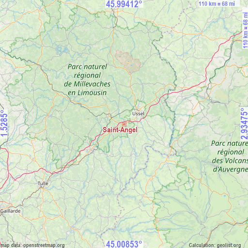
Saint-Angel GPS coordinates[2]
45° 30' 12.528" North, 2° 13' 53.832" East
| Map corner | latitude | longitude |
|---|---|---|
| Upper-left | 45.99412°, | 1.5285° |
| Center: | 45.50348°, | 2.23162° |
| Lower-right: | 45.00853°, | 2.93475° |
| Map W x H: | 109.6×109.6 km | = 68.1×68.1mi |
| max Lat: | 51.07786° ⇑74.1% North |
| Saint-Angel: | 45.50348° |
| min Lat: | ⇓25.9% South 41.3874° |
| min Long | Saint-Angel | max Long |
| -5.08615° | 2.23162° | 9.52242° |
| W 46.1%⇐ | ⇒53.9% E |
Elevation
Elevation of Saint-Angel is 643 m = 2110 ft, and this is 449.3 m = 1474 ft above average elevation for this country.
| Max E: |
2333 m = 7654 ft | 4% |
| Saint-Angel | 643 m 2110 ft | |
| Avg. | 193.7 m = 635 ft | |
Min E: |
-1 m = -3 ft | 96% |
See also: France elevation on elevation.city.
Geographical zone
Saint-Angel is located in North temperate zone (between Tropic of Cancer and the Arctic Circle). Distance of this North polar circle is 2341.7 km =1455.1 mi to North.| Distance of | km | miles | from Saint-Angel |
|---|---|---|---|
| North Pole | 4947.5 | 3074.2 | to North |
| Arctic Circle | 2341.7 | 1455.1 | to North |
| Tropic Cancer | 2453.6 | 1524.6 | to South |
| Equator | 5059.5 | 3143.8 | to South |


Nearby cities:
15 places around Saint-Angel: (largest is in red/bold)
• Bort-les-Orgues
23.6 km =14.7 mi,  119°
119°
• Champagnac
20.9 km =13 mi,  141°
141°
• Eygurande
24.5 km =15.2 mi,  44°
44°
• La Courtine
22.1 km =13.7 mi,  6°
6°
• La Feuillade
8.7 km =5.4 mi,  324°
324°
• Lanobre
24.7 km =15.3 mi,  106°
106°
• Merlines
23.3 km =14.5 mi,  51°
51°
• Meymac
7.5 km =4.7 mi,  298°
298°
• Neuvic
13.9 km =8.6 mi,  167°
167°
• Saint-Exupéry-les-Roches
10.8 km =6.7 mi,  82°
82°
• Saint-Hippolyte
23.9 km =14.9 mi,  226°
226°
• Sornac
18.5 km =11.5 mi,  350°
350°
• Ussel
7.8 km =4.8 mi, 50°
• Ydes
23.7 km =14.7 mi, 137°
• Égletons
18.1 km =11.2 mi, 233°
Sources, notices
• [Note1] Compared only with cities in France existing in our database
• [Src1] Map data: © OpenStreetMap contributors (CC-BY-SA)
• [Src2] Other city data from geonames.org with taken over terms of usage.
• [Src3] Geographical zone / Annual Mean Temperature by Robert A. Rohde @ Wikipedia
