Égletons geodata
Égletons (Nouvelle-Aquitaine) is a populated place; located in France in Europe/Paris (GMT+2) time zone. With population of 5,316 people, there are 1854 cities with bigger population in this country. Compared to other cities in France, 75.1% of cities are located further ↑North; 56.5% of cities are located further →East and 95.5% of cities have lower elevation than Égletons. Note1
Administrative division(s):
- Level 1: Nouvelle-Aquitaine
- Level 2: Département de la Corrèze
- Level 3: Ussel
- Level 4: Égletons


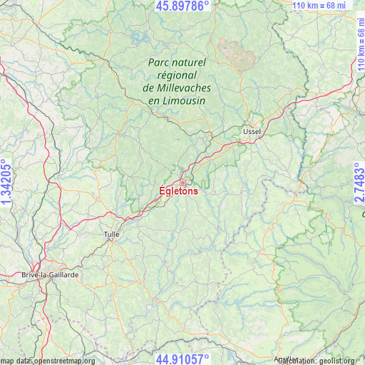
Égletons GPS coordinates[2]
45° 24' 22.932" North, 2° 2' 42.648" East
| Map corner | latitude | longitude |
|---|---|---|
| Upper-left | 45.89786°, | 1.34205° |
| Center: | 45.40637°, | 2.04518° |
| Lower-right: | 44.91057°, | 2.7483° |
| Map W x H: | 109.8×109.8 km | = 68.2×68.2mi |
| max Lat: | 51.07786° ⇑75.1% North |
| Égletons: | 45.40637° |
| min Lat: | ⇓24.9% South 41.3874° |
| min Long | Égletons | max Long |
| -5.08615° | 2.04518° | 9.52242° |
| W 43.5%⇐ | ⇒56.5% E |
Elevation
Elevation of Égletons is 612 m = 2008 ft, and this is 418.3 m = 1372 ft above average elevation for this country.
| Max E: |
2333 m = 7654 ft | 4.5% |
| Égletons | 612 m 2008 ft | |
| Avg. | 193.7 m = 635 ft | |
Min E: |
-1 m = -3 ft | 95.5% |
See also: France elevation on elevation.city.
Geographical zone
Égletons is located in North temperate zone (between Tropic of Cancer and the Arctic Circle). Distance of this North polar circle is 2352.5 km =1461.8 mi to North.| Distance of | km | miles | from Égletons |
|---|---|---|---|
| North Pole | 4958.3 | 3080.9 | to North |
| Arctic Circle | 2352.5 | 1461.8 | to North |
| Tropic Cancer | 2442.8 | 1517.9 | to South |
| Equator | 5048.7 | 3137.1 | to South |


Nearby cities:
15 places around Égletons: (largest is in red/bold)
• Bugeat
23.2 km =14.4 mi,  336°
336°
• Chanac-les-Mines
23.7 km =14.7 mi,  228°
228°
• Corrèze
13.8 km =8.6 mi,  254°
254°
• Eyrein
11.2 km =7 mi,  224°
224°
• Gimel-les-Cascades
19.3 km =12 mi, 231°
• La Feuillade
20.2 km =12.6 mi,  27°
27°
• Le Lonzac
25.5 km =15.8 mi,  284°
284°
• Marcillac-la-Croisille
14.9 km =9.3 mi,  184°
184°
• Meymac
16.4 km =10.2 mi, 28°
• Naves
24 km =14.9 mi,  244°
244°
• Neuvic
17.9 km =11.1 mi,  98°
98°
• Saint-Angel
18.1 km =11.2 mi,  53°
53°
• Saint-Hippolyte
6.4 km =4 mi,  205°
205°
• Soursac
19 km =11.8 mi,  140°
140°
• Treignac
24.3 km =15.1 mi,  306°
306°
Sources, notices
• [Note1] Compared only with cities in France existing in our database
• [Src1] Map data: © OpenStreetMap contributors (CC-BY-SA)
• [Src2] Other city data from geonames.org with taken over terms of usage.
• [Src3] Geographical zone / Annual Mean Temperature by Robert A. Rohde @ Wikipedia
