Lacs geodata
Lacs (Centre) is a populated place; located in France in Europe/Paris (GMT+2) time zone. With population of 621 people, there are 12967 cities with bigger population in this country. Compared to other cities in France, 59.4% of cities are located further ↑North; 56.8% of cities are located further →East and 69.9% of cities have lower elevation than Lacs. Note1
Administrative division(s):
- Level 1: Centre
- Level 2: Département de l'Indre
- Level 3: Arrondissement de La Châtre
- Level 4: Lacs


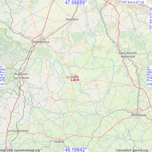
Lacs GPS coordinates[2]
46° 35' 8.916" North, 2° 1' 29.46" East
| Map corner | latitude | longitude |
|---|---|---|
| Upper-left | 47.06689°, | 1.32172° |
| Center: | 46.58581°, | 2.02485° |
| Lower-right: | 46.10042°, | 2.72797° |
| Map W x H: | 107.5×107.5 km | = 66.8×66.8mi |
| max Lat: | 51.07786° ⇑59.4% North |
| Lacs: | 46.58581° |
| min Lat: | ⇓40.6% South 41.3874° |
| min Long | Lacs | max Long |
| -5.08615° | 2.02485° | 9.52242° |
| W 43.2%⇐ | ⇒56.8% E |
Elevation
Elevation of Lacs is 219 m = 719 ft, and this is 25.3 m = 83 ft above average elevation for this country.
| Max E: |
2333 m = 7654 ft | 30.1% |
| Lacs | 219 m 719 ft | |
| Avg. | 193.7 m = 635 ft | |
Min E: |
-1 m = -3 ft | 69.9% |
See also: France elevation on elevation.city.
Geographical zone
Lacs is located in North temperate zone (between Tropic of Cancer and the Arctic Circle). Distance of this North polar circle is 2221.3 km =1380.3 mi to North.| Distance of | km | miles | from Lacs |
|---|---|---|---|
| North Pole | 4827.2 | 2999.5 | to North |
| Arctic Circle | 2221.3 | 1380.3 | to North |
| Tropic Cancer | 2573.9 | 1599.3 | to South |
| Equator | 5179.9 | 3218.6 | to South |


Nearby cities:
15 places around Lacs: (largest is in red/bold)
• Briantes
3.2 km =2 mi,  184°
184°
• Chassignolles
8.2 km =5.1 mi,  232°
232°
• Châteaumeillant
13.3 km =8.3 mi,  101°
101°
• La Châtre
2.9 km =1.8 mi,  262°
262°
• Le Châtelet
20.6 km =12.8 mi,  72°
72°
• Le Magny
5.6 km =3.5 mi,  249°
249°
• Mers-sur-Indre
13.7 km =8.5 mi,  306°
306°
• Montgivray
3.8 km =2.4 mi,  300°
300°
• Montipouret
11.9 km =7.4 mi, 306°
• Neuvy-Saint-Sépulchre
16.8 km =10.4 mi,  274°
274°
• Pouligny-Notre-Dame
11.4 km =7.1 mi, 183°
• Saint-Août
16.8 km =10.4 mi,  344°
344°
• Saint-Chartier
7.9 km =4.9 mi,  332°
332°
• Saint-Hilaire-en-Lignières
19.3 km =12 mi,  35°
35°
• Sainte-Sévère-sur-Indre
11.6 km =7.2 mi,  162°
162°
Sources, notices
• [Note1] Compared only with cities in France existing in our database
• [Src1] Map data: © OpenStreetMap contributors (CC-BY-SA)
• [Src2] Other city data from geonames.org with taken over terms of usage.
• [Src3] Geographical zone / Annual Mean Temperature by Robert A. Rohde @ Wikipedia
