Montgivray geodata
Montgivray (Centre) is a populated place; located in France in Europe/Paris (GMT+2) time zone. With population of 1,707 people, there are 5499 cities with bigger population in this country. Compared to other cities in France, 59.2% of cities are located further ↑North; 57.4% of cities are located further →East and 67.8% of cities have lower elevation than Montgivray. Note1
Administrative division(s):
- Level 1: Centre
- Level 2: Département de l'Indre
- Level 3: Arrondissement de La Châtre
- Level 4: Montgivray


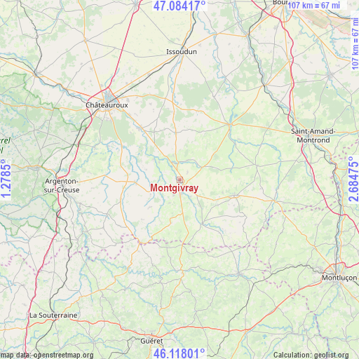
Montgivray GPS coordinates[2]
46° 36' 11.664" North, 1° 58' 53.832" East
| Map corner | latitude | longitude |
|---|---|---|
| Upper-left | 47.08417°, | 1.2785° |
| Center: | 46.60324°, | 1.98162° |
| Lower-right: | 46.11801°, | 2.68475° |
| Map W x H: | 107.4×107.4 km | = 66.7×66.7mi |
| max Lat: | 51.07786° ⇑59.2% North |
| Montgivray: | 46.60324° |
| min Lat: | ⇓40.8% South 41.3874° |
| min Long | Montgivray | max Long |
| -5.08615° | 1.98162° | 9.52242° |
| W 42.6%⇐ | ⇒57.4% E |
Elevation
Elevation of Montgivray is 208 m = 682 ft, and this is 14.3 m = 47 ft above average elevation for this country.
| Max E: |
2333 m = 7654 ft | 32.2% |
| Montgivray | 208 m 682 ft | |
| Avg. | 193.7 m = 635 ft | |
Min E: |
-1 m = -3 ft | 67.8% |
See also: France elevation on elevation.city.
Geographical zone
Montgivray is located in North temperate zone (between Tropic of Cancer and the Arctic Circle). Distance of this North polar circle is 2219.4 km =1379.1 mi to North.| Distance of | km | miles | from Montgivray |
|---|---|---|---|
| North Pole | 4825.3 | 2998.3 | to North |
| Arctic Circle | 2219.4 | 1379.1 | to North |
| Tropic Cancer | 2575.9 | 1600.6 | to South |
| Equator | 5181.8 | 3219.8 | to South |


Nearby cities:
15 places around Montgivray: (largest is in red/bold)
• Ardentes
19.1 km =11.9 mi,  323°
323°
• Briantes
5.9 km =3.7 mi,  148°
148°
• Chassignolles
7.6 km =4.7 mi,  204°
204°
• Châteaumeillant
16.9 km =10.5 mi,  105°
105°
• Cluis
18.9 km =11.7 mi,  249°
249°
• La Châtre
2.4 km =1.5 mi,  169°
169°
• Lacs
3.8 km =2.4 mi,  120°
120°
• Le Magny
4.4 km =2.7 mi,  206°
206°
• Mers-sur-Indre
9.9 km =6.2 mi,  308°
308°
• Montipouret
8.1 km =5 mi, 309°
• Neuvy-Saint-Sépulchre
13.4 km =8.3 mi,  267°
267°
• Pouligny-Notre-Dame
13.6 km =8.5 mi, 168°
• Saint-Août
14.3 km =8.9 mi,  355°
355°
• Saint-Chartier
5.1 km =3.2 mi, 356°
• Sainte-Sévère-sur-Indre
14.6 km =9.1 mi, 152°
Sources, notices
• [Note1] Compared only with cities in France existing in our database
• [Src1] Map data: © OpenStreetMap contributors (CC-BY-SA)
• [Src2] Other city data from geonames.org with taken over terms of usage.
• [Src3] Geographical zone / Annual Mean Temperature by Robert A. Rohde @ Wikipedia
