Sainte-Sévère-sur-Indre geodata
Sainte-Sévère-sur-Indre (Centre) is a populated place; located in France in Europe/Paris (GMT+2) time zone. With population of 906 people, there are 9605 cities with bigger population in this country. Compared to other cities in France, 60.2% of cities are located further ↑North; 56.2% of cities are located further →East and 80.6% of cities have lower elevation than Sainte-Sévère-sur-Indre. Note1
Administrative division(s):
- Level 1: Centre
- Level 2: Département de l'Indre
- Level 3: Arrondissement de La Châtre
- Level 4: Sainte-Sévère-sur-Indre
Current local time in Sainte-Sévère-sur-Indre:
05:24 AM, SaturdayDifference from your time zone: hours


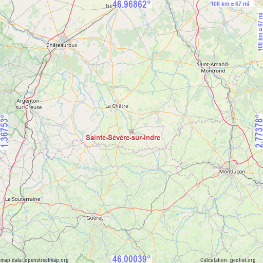
Sainte-Sévère-sur-Indre GPS coordinates[2]
46° 29' 11.976" North, 2° 4' 14.376" East
| Map corner | latitude | longitude |
|---|---|---|
| Upper-left | 46.96862°, | 1.36753° |
| Center: | 46.48666°, | 2.07066° |
| Lower-right: | 46.00039°, | 2.77378° |
| Map W x H: | 107.7×107.7 km | = 66.9×66.9mi |
| max Lat: | 51.07786° ⇑60.2% North |
| Sainte-Sévère-sur-Indre: | 46.48666° |
| min Lat: | ⇓39.8% South 41.3874° |
| min Long | Sainte-Sévère | max Long |
| -5.08615° | 2.07066° | 9.52242° |
| W 43.8%⇐ | ⇒56.2% E |
Elevation
Elevation of Sainte-Sévère-sur-Indre is 297 m = 974 ft, and this is 103.3 m = 339 ft above average elevation for this country.
| Max E: |
2333 m = 7654 ft | 19.4% |
| Sainte-Sévère-sur-Indre | 297 m 974 ft | |
| Avg. | 193.7 m = 635 ft | |
Min E: |
-1 m = -3 ft | 80.6% |
See also: France elevation on elevation.city.
Geographical zone
Sainte-Sévère-sur-Indre is located in North temperate zone (between Tropic of Cancer and the Arctic Circle). Distance of this North polar circle is 2232.3 km =1387.1 mi to North.| Distance of | km | miles | from Sainte-Sévère-sur-Indre |
|---|---|---|---|
| North Pole | 4838.2 | 3006.3 | to North |
| Arctic Circle | 2232.3 | 1387.1 | to North |
| Tropic Cancer | 2562.9 | 1592.5 | to South |
| Equator | 5168.8 | 3211.7 | to South |


Nearby cities:
15 places around Sainte-Sévère-sur-Indre: (largest is in red/bold)
• Aigurande
19.3 km =12 mi,  252°
252°
• Boussac
19.2 km =11.9 mi,  143°
143°
• Boussac-Bourg
18.8 km =11.7 mi, 138°
• Briantes
8.7 km =5.4 mi,  334°
334°
• Chassignolles
11.7 km =7.3 mi,  301°
301°
• Châteaumeillant
12.7 km =7.9 mi,  48°
48°
• Genouillac
16.1 km =10 mi,  201°
201°
• La Châtre
12.4 km =7.7 mi, 329°
• Lacs
11.6 km =7.2 mi,  342°
342°
• Le Magny
12.6 km =7.8 mi,  315°
315°
• Montgivray
14.6 km =9.1 mi, 332°
• Moutier-Malcard
14.1 km =8.8 mi,  223°
223°
• Pouligny-Notre-Dame
4.1 km =2.5 mi,  264°
264°
• Préveranges
15.3 km =9.5 mi,  112°
112°
• Saint-Chartier
19.4 km =12.1 mi, 338°
Sources, notices
• [Note1] Compared only with cities in France existing in our database
• [Src1] Map data: © OpenStreetMap contributors (CC-BY-SA)
• [Src2] Other city data from geonames.org with taken over terms of usage.
• [Src3] Geographical zone / Annual Mean Temperature by Robert A. Rohde @ Wikipedia
