Lacropte geodata
Lacropte (Nouvelle-Aquitaine) is a populated place; located in France in Europe/Paris (GMT+2) time zone. With population of 637 people, there are 12716 cities with bigger population in this country. Compared to other cities in France, 79.2% of cities are located further ↑North; 70.3% of cities are located further →East and 66.2% of cities have lower elevation than Lacropte. Note1
Administrative division(s):
- Level 1: Nouvelle-Aquitaine
- Level 2: Dordogne
- Level 3: Arrondissement de Périgueux
- Level 4: Lacropte


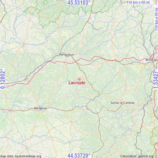
Lacropte GPS coordinates[2]
45° 2' 10.752" North, 0° 49' 52.104" East
| Map corner | latitude | longitude |
|---|---|---|
| Upper-left | 45.53103°, | 0.12802° |
| Center: | 45.03632°, | 0.83114° |
| Lower-right: | 44.53729°, | 1.53427° |
| Map W x H: | 110.5×110.5 km | = 68.7×68.7mi |
| max Lat: | 51.07786° ⇑79.2% North |
| Lacropte: | 45.03632° |
| min Lat: | ⇓20.8% South 41.3874° |
| min Long | Lacropte | max Long |
| -5.08615° | 0.83114° | 9.52242° |
| W 29.7%⇐ | ⇒70.3% E |
Elevation
Elevation of Lacropte is 200 m = 656 ft, and this is 6.3 m = 21 ft above average elevation for this country.
| Max E: |
2333 m = 7654 ft | 33.8% |
| Lacropte | 200 m 656 ft | |
| Avg. | 193.7 m = 635 ft | |
Min E: |
-1 m = -3 ft | 66.2% |
See also: France elevation on elevation.city.
Geographical zone
Lacropte is located in North temperate zone (between Tropic of Cancer and the Arctic Circle). Distance of this North polar circle is 2393.6 km =1487.3 mi to North.| Distance of | km | miles | from Lacropte |
|---|---|---|---|
| North Pole | 4999.5 | 3106.5 | to North |
| Arctic Circle | 2393.6 | 1487.3 | to North |
| Tropic Cancer | 2401.7 | 1492.3 | to South |
| Equator | 5007.6 | 3111.6 | to South |


Nearby cities:
15 places around Lacropte: (largest is in red/bold)
• Atur
13.4 km =8.3 mi,  330°
330°
• Boulazac
11 km =6.8 mi,  324°
324°
• Cendrieux
4.5 km =2.8 mi,  187°
187°
• Eyliac
14.1 km =8.8 mi,  7°
7°
• Fossemagne
15.8 km =9.8 mi,  50°
50°
• La Douze
3.9 km =2.4 mi,  42°
42°
• Le Bugue
15.1 km =9.4 mi,  150°
150°
• Marsaneix
7.9 km =4.9 mi, 332°
• Notre-Dame-de-Sanilhac
13.3 km =8.3 mi, 315°
• Plazac
16.5 km =10.3 mi,  90°
90°
• Rouffignac-Saint-Cernin-de-Reilhac
10.8 km =6.7 mi,  81°
81°
• Saint-Laurent-sur-Manoire
12.8 km =8 mi,  347°
347°
• Saint-Pierre-de-Chignac
9.9 km =6.2 mi, 11°
• Sainte-Alvère
9.7 km =6 mi, 186°
• Vergt
8.9 km =5.5 mi,  263°
263°
Sources, notices
• [Note1] Compared only with cities in France existing in our database
• [Src1] Map data: © OpenStreetMap contributors (CC-BY-SA)
• [Src2] Other city data from geonames.org with taken over terms of usage.
• [Src3] Geographical zone / Annual Mean Temperature by Robert A. Rohde @ Wikipedia
