Cendrieux geodata
Cendrieux (Nouvelle-Aquitaine) is a populated place; located in France in Europe/Paris (GMT+2) time zone. With population of 590 people, there are 13479 cities with bigger population in this country. Compared to other cities in France, 79.7% of cities are located further ↑North; 70.3% of cities are located further →East and 72.4% of cities have lower elevation than Cendrieux. Note1
Administrative division(s):
- Level 1: Nouvelle-Aquitaine
- Level 2: Dordogne
- Level 3: Arrondissement de Périgueux
- Level 4: Val de Louyre et Caudeau


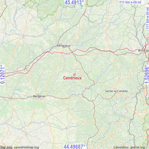
Cendrieux GPS coordinates[2]
44° 59' 46.464" North, 0° 49' 25.824" East
| Map corner | latitude | longitude |
|---|---|---|
| Upper-left | 45.4913°, | 0.12071° |
| Center: | 44.99624°, | 0.82384° |
| Lower-right: | 44.49687°, | 1.52696° |
| Map W x H: | 110.6×110.6 km | = 68.7×68.7mi |
| max Lat: | 51.07786° ⇑79.7% North |
| Cendrieux: | 44.99624° |
| min Lat: | ⇓20.3% South 41.3874° |
| min Long | Cendrieux | max Long |
| -5.08615° | 0.82384° | 9.52242° |
| W 29.7%⇐ | ⇒70.3% E |
Elevation
Elevation of Cendrieux is 232 m = 761 ft, and this is 38.3 m = 126 ft above average elevation for this country.
| Max E: |
2333 m = 7654 ft | 27.6% |
| Cendrieux | 232 m 761 ft | |
| Avg. | 193.7 m = 635 ft | |
Min E: |
-1 m = -3 ft | 72.4% |
See also: France elevation on elevation.city.
Geographical zone
Cendrieux is located in North temperate zone (between Tropic of Cancer and the Arctic Circle). Distance of this Northern Tropic circle is 2397.2 km =1489.6 mi to South.| Distance of | km | miles | from Cendrieux |
|---|---|---|---|
| North Pole | 5003.9 | 3109.3 | to North |
| Arctic Circle | 2398.1 | 1490.1 | to North |
| Tropic Cancer | 2397.2 | 1489.6 | to South |
| Equator | 5003.1 | 3108.8 | to South |


Nearby cities:
15 places around Cendrieux: (largest is in red/bold)
• Atur
17.2 km =10.7 mi,  339°
339°
• Boulazac
14.6 km =9.1 mi, 336°
• La Douze
8 km =5 mi,  23°
23°
• Lacropte
4.5 km =2.8 mi,  7°
7°
• Le Bugue
11.9 km =7.4 mi,  136°
136°
• Les Eyzies-de-Tayac-Sireuil
16.3 km =10.1 mi,  114°
114°
• Marsaneix
11.8 km =7.3 mi, 344°
• Mauzac-et-Grand-Castang
14.8 km =9.2 mi,  192°
192°
• Notre-Dame-de-Sanilhac
16.5 km =10.3 mi,  327°
327°
• Rouffignac-Saint-Cernin-de-Reilhac
12.7 km =7.9 mi,  61°
61°
• Saint-Laurent-sur-Manoire
17.1 km =10.6 mi,  352°
352°
• Saint-Pierre-de-Chignac
14.4 km =8.9 mi, 10°
• Sainte-Alvère
5.2 km =3.2 mi, 186°
• Trémolat
13.5 km =8.4 mi,  177°
177°
• Vergt
9 km =5.6 mi,  292°
292°
Sources, notices
• [Note1] Compared only with cities in France existing in our database
• [Src1] Map data: © OpenStreetMap contributors (CC-BY-SA)
• [Src2] Other city data from geonames.org with taken over terms of usage.
• [Src3] Geographical zone / Annual Mean Temperature by Robert A. Rohde @ Wikipedia
