Le Bugue geodata
Le Bugue (Nouvelle-Aquitaine) is a populated place; located in France in Europe/Paris (GMT+2) time zone. With population of 2,928 people, there are 3331 cities with bigger population in this country. Compared to other cities in France, 80.3% of cities are located further ↑North; 69.4% of cities are located further →East and 76.2% of cities have higher elevation than Le Bugue. Note1
Administrative division(s):
- Level 1: Nouvelle-Aquitaine
- Level 2: Dordogne
- Level 3: Arrondissement de Sarlat-la-Canéda
- Level 4: Le Bugue


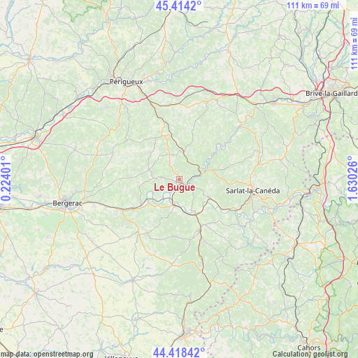
Le Bugue GPS coordinates[2]
44° 55' 6.492" North, 0° 55' 37.704" East
| Map corner | latitude | longitude |
|---|---|---|
| Upper-left | 45.4142°, | 0.22401° |
| Center: | 44.91847°, | 0.92714° |
| Lower-right: | 44.41842°, | 1.63026° |
| Map W x H: | 110.7×110.7 km | = 68.8×68.8mi |
| max Lat: | 51.07786° ⇑80.3% North |
| Le Bugue: | 44.91847° |
| min Lat: | ⇓19.7% South 41.3874° |
| min Long | Le Bugue | max Long |
| -5.08615° | 0.92714° | 9.52242° |
| W 30.6%⇐ | ⇒69.4% E |
Elevation
Elevation of Le Bugue is 64 m = 210 ft, and this is 129.7 m = 426 ft below average elevation for this country.
| Max E: |
2333 m = 7654 ft | 76.2% |
| Avg. | 193.7 m = 635 ft | |
| Le Bugue | 64 m = 210 ft | |
Min E: |
-1 m = -3 ft | 23.8% |
See also: France elevation on elevation.city.
Geographical zone
Le Bugue is located in North temperate zone (between Tropic of Cancer and the Arctic Circle). Distance of this Northern Tropic circle is 2388.5 km =1484.1 mi to South.| Distance of | km | miles | from Le Bugue |
|---|---|---|---|
| North Pole | 5012.6 | 3114.7 | to North |
| Arctic Circle | 2406.7 | 1495.5 | to North |
| Tropic Cancer | 2388.5 | 1484.1 | to South |
| Equator | 4994.5 | 3103.4 | to South |


Nearby cities:
15 places around Le Bugue: (largest is in red/bold)
• Belvès
17 km =10.6 mi,  158°
158°
• Cendrieux
11.9 km =7.4 mi,  316°
316°
• Coux-et-Bigaroque
10.1 km =6.3 mi, 158°
• La Douze
16.7 km =10.4 mi,  342°
342°
• Lacropte
15.1 km =9.4 mi,  330°
330°
• Le Buisson-de-Cadouin
7.7 km =4.8 mi,  186°
186°
• Les Eyzies-de-Tayac-Sireuil
7.1 km =4.4 mi,  74°
74°
• Marquay
17.9 km =11.1 mi,  78°
78°
• Mauzac-et-Grand-Castang
12.7 km =7.9 mi,  243°
243°
• Plazac
15.7 km =9.8 mi,  34°
34°
• Rouffignac-Saint-Cernin-de-Reilhac
15 km =9.3 mi,  12°
12°
• Saint-Cyprien
10.5 km =6.5 mi,  121°
121°
• Sainte-Alvère
9.4 km =5.8 mi,  291°
291°
• Siorac-en-Périgord
11.7 km =7.3 mi, 156°
• Trémolat
9 km =5.6 mi, 237°
Sources, notices
• [Note1] Compared only with cities in France existing in our database
• [Src1] Map data: © OpenStreetMap contributors (CC-BY-SA)
• [Src2] Other city data from geonames.org with taken over terms of usage.
• [Src3] Geographical zone / Annual Mean Temperature by Robert A. Rohde @ Wikipedia
