Chevaigné geodata
Chevaigné (Brittany) is a populated place; located in France in Europe/Paris (GMT+2) time zone. With population of 1,756 people, there are 5395 cities with bigger population in this country. Compared to other cities in France, 63% of cities are located further ↓South; 93.2% of cities are located further →East and 74.1% of cities have higher elevation than Chevaigné. Note1
Administrative division(s):
- Level 1: Brittany
- Level 2: Département d'Ille-et-Vilaine
- Level 3: Arrondissement de Rennes
- Level 4: Chevaigné


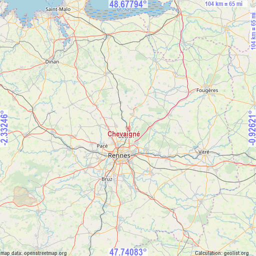
Chevaigné GPS coordinates[2]
48° 12' 41.508" North, 1° 37' 45.588" West
| Map corner | latitude | longitude |
|---|---|---|
| Upper-left | 48.67794°, | -2.33246° |
| Center: | 48.21153°, | -1.62933° |
| Lower-right: | 47.74083°, | -0.92621° |
| Map W x H: | 104.2×104.2 km | = 64.7×64.7mi |
| max Lat: | 51.07786° ⇑37% North |
| Chevaigné: | 48.21153° |
| min Lat: | ⇓63% South 41.3874° |
| min Long | Chevaigné | max Long |
| -5.08615° | -1.62933° | 9.52242° |
| W 6.8%⇐ | ⇒93.2% E |
Elevation
Elevation of Chevaigné is 69 m = 226 ft, and this is 124.7 m = 409 ft below average elevation for this country.
| Max E: |
2333 m = 7654 ft | 74.1% |
| Avg. | 193.7 m = 635 ft | |
| Chevaigné | 69 m = 226 ft | |
Min E: |
-1 m = -3 ft | 25.9% |
See also: France elevation on elevation.city.
Geographical zone
Chevaigné is located in North temperate zone (between Tropic of Cancer and the Arctic Circle). Distance of this North polar circle is 2040.6 km =1268 mi to North.| Distance of | km | miles | from Chevaigné |
|---|---|---|---|
| North Pole | 4646.4 | 2887.1 | to North |
| Arctic Circle | 2040.6 | 1268 | to North |
| Tropic Cancer | 2754.7 | 1711.7 | to South |
| Equator | 5360.6 | 3330.9 | to South |


Nearby cities:
15 places around Chevaigné: (largest is in red/bold)
• Andouillé-Neuville
9.5 km =5.9 mi,  18°
18°
• Betton
3.5 km =2.2 mi,  190°
190°
• Chasné-sur-Illet
6.1 km =3.8 mi,  55°
55°
• Fouillard
7 km =4.3 mi,  147°
147°
• La Chapelle-des-Fougeretz
8.5 km =5.3 mi,  243°
243°
• La Mézière
9.4 km =5.8 mi,  274°
274°
• Liffré
9 km =5.6 mi,  88°
88°
• Melesse
4.9 km =3 mi,  278°
278°
• Montgermont
8.8 km =5.5 mi,  225°
225°
• Montreuil-le-Gast
8.1 km =5 mi,  298°
298°
• Mouazé
2.7 km =1.7 mi,  33°
33°
• Saint-Germain-sur-Ille
4.7 km =2.9 mi,  332°
332°
• Saint-Grégoire
8 km =5 mi,  212°
212°
• Saint-Médard-sur-Ille
7.1 km =4.4 mi,  341°
341°
• Saint-Sulpice-la-Forêt
3.7 km =2.3 mi,  81°
81°
Sources, notices
• [Note1] Compared only with cities in France existing in our database
• [Src1] Map data: © OpenStreetMap contributors (CC-BY-SA)
• [Src2] Other city data from geonames.org with taken over terms of usage.
• [Src3] Geographical zone / Annual Mean Temperature by Robert A. Rohde @ Wikipedia
