Lablachère geodata
Lablachère (Auvergne-Rhône-Alpes) is a populated place; located in France in Europe/Paris (GMT+2) time zone. With population of 1,602 people, there are 5826 cities with bigger population in this country. Compared to other cities in France, 83.8% of cities are located further ↑North; 69.8% of cities are located further ←West and 74.3% of cities have lower elevation than Lablachère. Note1
Administrative division(s):
- Level 1: Auvergne-Rhône-Alpes
- Level 2: Département de l'Ardèche
- Level 3: Arrondissement de Largentière
- Level 4: Lablachère


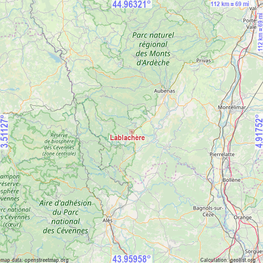
Lablachère GPS coordinates[2]
44° 27' 48.78" North, 4° 12' 51.804" East
| Map corner | latitude | longitude |
|---|---|---|
| Upper-left | 44.96321°, | 3.51127° |
| Center: | 44.46355°, | 4.21439° |
| Lower-right: | 43.95958°, | 4.91752° |
| Map W x H: | 111.6×111.6 km | = 69.3×69.3mi |
| max Lat: | 51.07786° ⇑83.8% North |
| Lablachère: | 44.46355° |
| min Lat: | ⇓16.2% South 41.3874° |
| min Long | Lablachère | max Long |
| -5.08615° | 4.21439° | 9.52242° |
| W 69.8%⇐ | ⇒30.2% E |
Elevation
Elevation of Lablachère is 244 m = 801 ft, and this is 50.3 m = 165 ft above average elevation for this country.
| Max E: |
2333 m = 7654 ft | 25.7% |
| Lablachère | 244 m 801 ft | |
| Avg. | 193.7 m = 635 ft | |
Min E: |
-1 m = -3 ft | 74.3% |
See also: France elevation on elevation.city.
Geographical zone
Lablachère is located in North temperate zone (between Tropic of Cancer and the Arctic Circle). Distance of this Northern Tropic circle is 2338 km =1452.8 mi to South.| Distance of | km | miles | from Lablachère |
|---|---|---|---|
| North Pole | 5063.2 | 3146.1 | to North |
| Arctic Circle | 2457.3 | 1526.9 | to North |
| Tropic Cancer | 2338 | 1452.8 | to South |
| Equator | 4943.9 | 3072 | to South |


Nearby cities:
15 places around Lablachère: (largest is in red/bold)
• Banne
11.7 km =7.3 mi,  203°
203°
• Berrias-et-Casteljau
10.8 km =6.7 mi,  186°
186°
• Chambonas
8.5 km =5.3 mi,  232°
232°
• Chassiers
11.7 km =7.3 mi,  33°
33°
• Grospierres
9.2 km =5.7 mi,  139°
139°
• Joyeuse
2.6 km =1.6 mi,  46°
46°
• Largentière
10.8 km =6.7 mi,  35°
35°
• Laurac-en-Vivarais
7.8 km =4.8 mi, 50°
• Les Assions
5.7 km =3.5 mi,  214°
214°
• Les Vans
9.2 km =5.7 mi, 225°
• Rosières
4.1 km =2.5 mi,  57°
57°
• Ruoms
10.2 km =6.3 mi,  96°
96°
• Saint-Paul-le-Jeune
14.5 km =9 mi, 199°
• Salavas
15.2 km =9.4 mi,  120°
120°
• Vallon-Pont-d’Arc
15.6 km =9.7 mi,  113°
113°
Sources, notices
• [Note1] Compared only with cities in France existing in our database
• [Src1] Map data: © OpenStreetMap contributors (CC-BY-SA)
• [Src2] Other city data from geonames.org with taken over terms of usage.
• [Src3] Geographical zone / Annual Mean Temperature by Robert A. Rohde @ Wikipedia
