Berrias-et-Casteljau geodata
Berrias-et-Casteljau (Auvergne-Rhône-Alpes) is a populated place; located in France in Europe/Paris (GMT+2) time zone. With population of 600 people, there are 13316 cities with bigger population in this country. Compared to other cities in France, 84.5% of cities are located further ↑North; 69.7% of cities are located further ←West and 50.1% of cities have lower elevation than Berrias-et-Casteljau. Note1
Administrative division(s):
- Level 1: Auvergne-Rhône-Alpes
- Level 2: Département de l'Ardèche
- Level 3: Arrondissement de Largentière
- Level 4: Berrias-et-Casteljau


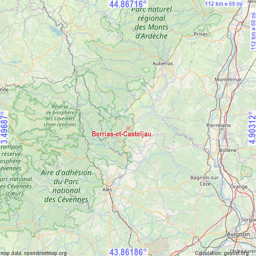
Berrias-et-Casteljau GPS coordinates[2]
44° 22' 0.012" North, 4° 12' 0" East
| Map corner | latitude | longitude |
|---|---|---|
| Upper-left | 44.86716°, | 3.49687° |
| Center: | 44.36667°, | 4.2° |
| Lower-right: | 43.86186°, | 4.90312° |
| Map W x H: | 111.8×111.8 km | = 69.5×69.5mi |
| max Lat: | 51.07786° ⇑84.5% North |
| Berrias-et-Casteljau: | 44.36667° |
| min Lat: | ⇓15.5% South 41.3874° |
| min Long | Berrias-et-Cast | max Long |
| -5.08615° | 4.2° | 9.52242° |
| W 69.7%⇐ | ⇒30.3% E |
Elevation
Elevation of Berrias-et-Casteljau is 132 m = 433 ft, and this is 61.7 m = 202 ft below average elevation for this country.
| Max E: |
2333 m = 7654 ft | 49.9% |
| Avg. | 193.7 m = 635 ft | |
| Berrias-et-Casteljau | 132 m = 433 ft | |
Min E: |
-1 m = -3 ft | 50.1% |
See also: France elevation on elevation.city.
Geographical zone
Berrias-et-Casteljau is located in North temperate zone (between Tropic of Cancer and the Arctic Circle). Distance of this Northern Tropic circle is 2327.2 km =1446.1 mi to South.| Distance of | km | miles | from Berrias-et-Casteljau |
|---|---|---|---|
| North Pole | 5074 | 3152.8 | to North |
| Arctic Circle | 2468.1 | 1533.6 | to North |
| Tropic Cancer | 2327.2 | 1446.1 | to South |
| Equator | 4933.1 | 3065.3 | to South |


Nearby cities:
15 places around Berrias-et-Casteljau: (largest is in red/bold)
• Banne
3.5 km =2.2 mi,  270°
270°
• Bessèges
11.7 km =7.3 mi,  224°
224°
• Chambonas
8 km =5 mi,  314°
314°
• Gagnières
8.8 km =5.5 mi, 220°
• Grospierres
8 km =5 mi,  62°
62°
• Lablachère
10.8 km =6.7 mi,  6°
6°
• Les Assions
6.4 km =4 mi,  341°
341°
• Les Vans
6.9 km =4.3 mi, 308°
• Meyrannes
10.9 km =6.8 mi,  193°
193°
• Molières-sur-Cèze
12.3 km =7.6 mi,  195°
195°
• Robiac-Rochessadoule
12.3 km =7.6 mi,  205°
205°
• Saint-Ambroix
12 km =7.5 mi,  180°
180°
• Saint-André-de-Cruzières
5.9 km =3.7 mi,  167°
167°
• Saint-Paul-le-Jeune
4.7 km =2.9 mi,  231°
231°
• Saint-Sauveur-de-Cruzières
8.6 km =5.3 mi,  150°
150°
Sources, notices
• [Note1] Compared only with cities in France existing in our database
• [Src1] Map data: © OpenStreetMap contributors (CC-BY-SA)
• [Src2] Other city data from geonames.org with taken over terms of usage.
• [Src3] Geographical zone / Annual Mean Temperature by Robert A. Rohde @ Wikipedia
