Labastide-d’Anjou geodata
Labastide-d’Anjou (Occitanie) is a populated place; located in France in Europe/Paris (GMT+2) time zone. With population of 957 people, there are 9150 cities with bigger population in this country. Compared to other cities in France, 94.9% of cities are located further ↑North; 58.8% of cities are located further →East and 63.8% of cities have lower elevation than Labastide-d’Anjou. Note1
Administrative division(s):
- Level 1: Occitanie
- Level 2: Département de l'Aude
- Level 3: Arrondissement de Carcassonne
- Level 4: Labastide-d'Anjou


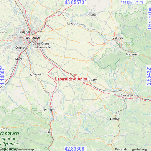
Labastide-d’Anjou GPS coordinates[2]
43° 20' 47.616" North, 1° 51' 4.284" East
| Map corner | latitude | longitude |
|---|---|---|
| Upper-left | 43.85573°, | 1.14807° |
| Center: | 43.34656°, | 1.85119° |
| Lower-right: | 42.83308°, | 2.55432° |
| Map W x H: | 113.7×113.7 km | = 70.6×70.6mi |
| max Lat: | 51.07786° ⇑94.9% North |
| Labastide-d’Anjou: | 43.34656° |
| min Lat: | ⇓5.1% South 41.3874° |
| min Long | Labastide-d’A | max Long |
| -5.08615° | 1.85119° | 9.52242° |
| W 41.2%⇐ | ⇒58.8% E |
Elevation
Elevation of Labastide-d’Anjou is 188 m = 617 ft, and this is 5.7 m = 19 ft below average elevation for this country.
| Max E: |
2333 m = 7654 ft | 36.2% |
| Avg. | 193.7 m = 635 ft | |
| Labastide-d’Anjou | 188 m = 617 ft | |
Min E: |
-1 m = -3 ft | 63.8% |
See also: France elevation on elevation.city.
Geographical zone
Labastide-d’Anjou is located in North temperate zone (between Tropic of Cancer and the Arctic Circle). Distance of this Northern Tropic circle is 2213.8 km =1375.6 mi to South.| Distance of | km | miles | from Labastide-d’Anjou |
|---|---|---|---|
| North Pole | 5187.4 | 3223.3 | to North |
| Arctic Circle | 2581.5 | 1604.1 | to North |
| Tropic Cancer | 2213.8 | 1375.6 | to South |
| Equator | 4819.7 | 2994.8 | to South |


Nearby cities:
15 places around Labastide-d’Anjou: (largest is in red/bold)
• Avignonet-Lauragais
4.7 km =2.9 mi,  298°
298°
• Castelnaudary
8.9 km =5.5 mi,  110°
110°
• Gardouch
14.5 km =9 mi,  289°
289°
• Lasbordes
16.7 km =10.4 mi, 110°
• Mas-Saintes-Puelles
4.3 km =2.7 mi,  150°
150°
• Mazères
17.7 km =11 mi,  232°
232°
• Montgaillard-Lauragais
15.5 km =9.6 mi,  307°
307°
• Pexiora
17.3 km =10.7 mi,  120°
120°
• Revel
17.5 km =10.9 mi,  44°
44°
• Saint-Félix-Lauragais
11.7 km =7.3 mi,  14°
14°
• Saint-Martin-Lalande
14.6 km =9.1 mi, 111°
• Saint-Papoul
15.1 km =9.4 mi,  96°
96°
• Salles-sur-l’Hers
8 km =5 mi,  221°
221°
• Villefranche-de-Lauragais
12.4 km =7.7 mi, 298°
• Villeneuve-la-Comptal
8.4 km =5.2 mi,  140°
140°
Sources, notices
• [Note1] Compared only with cities in France existing in our database
• [Src1] Map data: © OpenStreetMap contributors (CC-BY-SA)
• [Src2] Other city data from geonames.org with taken over terms of usage.
• [Src3] Geographical zone / Annual Mean Temperature by Robert A. Rohde @ Wikipedia
