Kerfot geodata
Kerfot (Brittany) is a populated place; located in France in Europe/Paris (GMT+2) time zone. With population of 588 people, there are 13513 cities with bigger population in this country. Compared to other cities in France, 74% of cities are located further ↓South; 97.4% of cities are located further →East and 69.2% of cities have higher elevation than Kerfot. Note1
Administrative division(s):
- Level 1: Brittany
- Level 2: Département des Côtes-d’Armor
- Level 3: Arrondissement de Guingamp
- Level 4: Kerfot


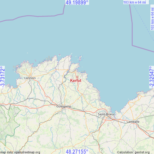
Kerfot GPS coordinates[2]
48° 44' 14.676" North, 3° 1' 42.924" West
| Map corner | latitude | longitude |
|---|---|---|
| Upper-left | 49.19899°, | -3.73172° |
| Center: | 48.73741°, | -3.02859° |
| Lower-right: | 48.27155°, | -2.32547° |
| Map W x H: | 103.1×103.1 km | = 64.1×64.1mi |
| max Lat: | 51.07786° ⇑26% North |
| Kerfot: | 48.73741° |
| min Lat: | ⇓74% South 41.3874° |
| min Long | Kerfot | max Long |
| -5.08615° | -3.02859° | 9.52242° |
| W 2.6%⇐ | ⇒97.4% E |
Elevation
Elevation of Kerfot is 80 m = 262 ft, and this is 113.7 m = 373 ft below average elevation for this country.
| Max E: |
2333 m = 7654 ft | 69.2% |
| Avg. | 193.7 m = 635 ft | |
| Kerfot | 80 m = 262 ft | |
Min E: |
-1 m = -3 ft | 30.8% |
See also: France elevation on elevation.city.
Geographical zone
Kerfot is located in North temperate zone (between Tropic of Cancer and the Arctic Circle). Distance of this North polar circle is 1982.1 km =1231.6 mi to North.| Distance of | km | miles | from Kerfot |
|---|---|---|---|
| North Pole | 4588 | 2850.9 | to North |
| Arctic Circle | 1982.1 | 1231.6 | to North |
| Tropic Cancer | 2813.2 | 1748 | to South |
| Equator | 5419.1 | 3367.3 | to South |


Nearby cities:
15 places around Kerfot: (largest is in red/bold)
• Lanvollon
12.2 km =7.6 mi,  165°
165°
• Lézardrieux
7.8 km =4.8 mi,  313°
313°
• Paimpol
4.7 km =2.9 mi,  346°
346°
• Pleudaniel
8.8 km =5.5 mi,  291°
291°
• Pleumeur-Gautier
11.7 km =7.3 mi, 306°
• Ploubazlanec
7 km =4.3 mi,  357°
357°
• Plouha
10 km =6.2 mi,  132°
132°
• Plourivo
3.2 km =2 mi, 286°
• Plouézec
3.6 km =2.2 mi,  64°
64°
• Ploëzal
13 km =8.1 mi,  259°
259°
• Pléhédel
4.8 km =3 mi,  161°
161°
• Pontrieux
10.4 km =6.5 mi,  247°
247°
• Quemper-Guézennec
6.8 km =4.2 mi,  236°
236°
• Saint-Clet
11.1 km =6.9 mi,  223°
223°
• Yvias
3.1 km =1.9 mi,  213°
213°
Sources, notices
• [Note1] Compared only with cities in France existing in our database
• [Src1] Map data: © OpenStreetMap contributors (CC-BY-SA)
• [Src2] Other city data from geonames.org with taken over terms of usage.
• [Src3] Geographical zone / Annual Mean Temperature by Robert A. Rohde @ Wikipedia
