Jonquières geodata
Jonquières (Provence-Alpes-Côte d'Azur) is a populated place; located in France in Europe/Paris (GMT+2) time zone. With population of 4,195 people, there are 2344 cities with bigger population in this country. Compared to other cities in France, 86.1% of cities are located further ↑North; 76.5% of cities are located further ←West and 80.2% of cities have higher elevation than Jonquières. Note1
Administrative division(s):
- Level 1: Provence-Alpes-Côte d'Azur
- Level 2: Département du Vaucluse
- Level 3: Arrondissement de Carpentras
- Level 4: Jonquières


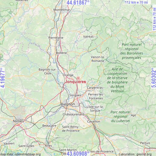
Jonquières GPS coordinates[2]
44° 6' 57.708" North, 4° 53' 59.604" East
| Map corner | latitude | longitude |
|---|---|---|
| Upper-left | 44.61867°, | 4.19677° |
| Center: | 44.11603°, | 4.89989° |
| Lower-right: | 43.60908°, | 5.60302° |
| Map W x H: | 112.3×112.3 km | = 69.8×69.8mi |
| max Lat: | 51.07786° ⇑86.1% North |
| Jonquières: | 44.11603° |
| min Lat: | ⇓13.9% South 41.3874° |
| min Long | Jonquières | max Long |
| -5.08615° | 4.89989° | 9.52242° |
| W 76.5%⇐ | ⇒23.5% E |
Elevation
Elevation of Jonquières is 54 m = 177 ft, and this is 139.7 m = 458 ft below average elevation for this country.
| Max E: |
2333 m = 7654 ft | 80.2% |
| Avg. | 193.7 m = 635 ft | |
| Jonquières | 54 m = 177 ft | |
Min E: |
-1 m = -3 ft | 19.8% |
See also: France elevation on elevation.city.
Geographical zone
Jonquières is located in North temperate zone (between Tropic of Cancer and the Arctic Circle). Distance of this Northern Tropic circle is 2299.3 km =1428.7 mi to South.| Distance of | km | miles | from Jonquières |
|---|---|---|---|
| North Pole | 5101.8 | 3170.1 | to North |
| Arctic Circle | 2495.9 | 1550.9 | to North |
| Tropic Cancer | 2299.3 | 1428.7 | to South |
| Equator | 4905.2 | 3047.9 | to South |


Nearby cities:
15 places around Jonquières: (largest is in red/bold)
• Aubignan
10.2 km =6.3 mi,  100°
100°
• Beaumes-de-Venise
10.5 km =6.5 mi,  86°
86°
• Bédarrides
8.4 km =5.2 mi,  180°
180°
• Caderousse
11.5 km =7.1 mi,  262°
262°
• Camaret-sur-Aigues
5.7 km =3.5 mi,  338°
338°
• Châteauneuf-du-Pape
8.5 km =5.3 mi,  219°
219°
• Courthézon
3.4 km =2.1 mi,  201°
201°
• Gigondas
9.9 km =6.2 mi,  57°
57°
• Loriol-du-Comtat
9.2 km =5.7 mi,  118°
118°
• Orange
7.6 km =4.7 mi,  288°
288°
• Sarrians
6.8 km =4.2 mi, 122°
• Sérignan-du-Comtat
9.3 km =5.8 mi,  331°
331°
• Travaillan
7.4 km =4.6 mi,  0°
0°
• Vacqueyras
7.1 km =4.4 mi,  69°
69°
• Violès
6.7 km =4.2 mi,  40°
40°
Sources, notices
• [Note1] Compared only with cities in France existing in our database
• [Src1] Map data: © OpenStreetMap contributors (CC-BY-SA)
• [Src2] Other city data from geonames.org with taken over terms of usage.
• [Src3] Geographical zone / Annual Mean Temperature by Robert A. Rohde @ Wikipedia
