Janvry geodata
Janvry (Île-de-France) is a populated place; located in France in Europe/Paris (GMT+2) time zone. With population of 622 people, there are 12950 cities with bigger population in this country. Compared to other cities in France, 72% of cities are located further ↓South; 55.1% of cities are located further →East and 59.8% of cities have lower elevation than Janvry. Note1
Administrative division(s):
- Level 1: Île-de-France
- Level 2: Département de l'Essonne
- Level 3: Arrondissement de Palaiseau
- Level 4: Janvry


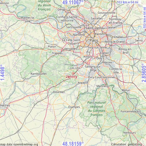
Janvry GPS coordinates[2]
48° 38' 53.772" North, 2° 9' 10.512" East
| Map corner | latitude | longitude |
|---|---|---|
| Upper-left | 49.11067°, | 1.4498° |
| Center: | 48.64827°, | 2.15292° |
| Lower-right: | 48.18159°, | 2.85605° |
| Map W x H: | 103.3×103.3 km | = 64.2×64.2mi |
| max Lat: | 51.07786° ⇑28% North |
| Janvry: | 48.64827° |
| min Lat: | ⇓72% South 41.3874° |
| min Long | Janvry | max Long |
| -5.08615° | 2.15292° | 9.52242° |
| W 44.9%⇐ | ⇒55.1% E |
Elevation
Elevation of Janvry is 169 m = 554 ft, and this is 24.7 m = 81 ft below average elevation for this country.
| Max E: |
2333 m = 7654 ft | 40.2% |
| Avg. | 193.7 m = 635 ft | |
| Janvry | 169 m = 554 ft | |
Min E: |
-1 m = -3 ft | 59.8% |
See also: France elevation on elevation.city.
Geographical zone
Janvry is located in North temperate zone (between Tropic of Cancer and the Arctic Circle). Distance of this North polar circle is 1992 km =1237.8 mi to North.| Distance of | km | miles | from Janvry |
|---|---|---|---|
| North Pole | 4597.9 | 2857 | to North |
| Arctic Circle | 1992 | 1237.8 | to North |
| Tropic Cancer | 2803.3 | 1741.9 | to South |
| Equator | 5409.2 | 3361.1 | to South |


Nearby cities:
15 places around Janvry: (largest is in red/bold)
• Briis-sous-Forges
3.6 km =2.2 mi,  220°
220°
• Bures-sur-Yvette
5.9 km =3.7 mi,  12°
12°
• Courson-Monteloup
5.3 km =3.3 mi,  182°
182°
• Fontenay-lès-Briis
3.2 km =2 mi, 180°
• Forges-les-Bains
4.2 km =2.6 mi,  240°
240°
• Gif-sur-Yvette
4.2 km =2.6 mi,  339°
339°
• Gometz-la-Ville
3.2 km =2 mi,  326°
326°
• Gometz-le-Châtel
3.5 km =2.2 mi, 341°
• Les Molières
6.7 km =4.2 mi,  294°
294°
• Les Ulis
3.9 km =2.4 mi,  18°
18°
• Limours
5.6 km =3.5 mi,  267°
267°
• Marcoussis
6.4 km =4 mi,  98°
98°
• Nozay
6.6 km =4.1 mi,  79°
79°
• Orsay
5.8 km =3.6 mi,  25°
25°
• Vaugrigneuse
5.6 km =3.5 mi,  203°
203°
Sources, notices
• [Note1] Compared only with cities in France existing in our database
• [Src1] Map data: © OpenStreetMap contributors (CC-BY-SA)
• [Src2] Other city data from geonames.org with taken over terms of usage.
• [Src3] Geographical zone / Annual Mean Temperature by Robert A. Rohde @ Wikipedia
