Issy-les-Moulineaux geodata
Issy-les-Moulineaux (Île-de-France) is a populated place; located in France in Europe/Paris (GMT+2) time zone. With population of 61,447 people, there are 81 cities with bigger population in this country. Compared to other cities in France, 76% of cities are located further ↓South; 53.1% of cities are located further →East and 73.6% of cities have higher elevation than Issy-les-Moulineaux. Note1
Administrative division(s):
- Level 1: Île-de-France
- Level 2: Hauts-de-Seine
- Level 3: Arrondissement de Boulogne-Billancourt
- Level 4: Issy-les-Moulineaux


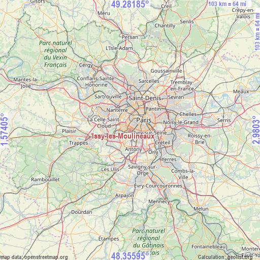
Issy-les-Moulineaux GPS coordinates[2]
48° 49' 15.744" North, 2° 16' 37.848" East
| Map corner | latitude | longitude |
|---|---|---|
| Upper-left | 49.28185°, | 1.57405° |
| Center: | 48.82104°, | 2.27718° |
| Lower-right: | 48.35595°, | 2.9803° |
| Map W x H: | 103×102.9 km | = 64×63.9mi |
| max Lat: | 51.07786° ⇑24% North |
| Issy-les-Moulineaux: | 48.82104° |
| min Lat: | ⇓76% South 41.3874° |
| min Long | Issy-les-Moulin | max Long |
| -5.08615° | 2.27718° | 9.52242° |
| W 46.9%⇐ | ⇒53.1% E |
Elevation
Elevation of Issy-les-Moulineaux is 70 m = 230 ft, and this is 123.7 m = 406 ft below average elevation for this country.
| Max E: |
2333 m = 7654 ft | 73.6% |
| Avg. | 193.7 m = 635 ft | |
| Issy-les-Moulineaux | 70 m = 230 ft | |
Min E: |
-1 m = -3 ft | 26.4% |
See also: Issy-les-Moulineaux elevation on elevation.city.
Geographical zone
Issy-les-Moulineaux is located in North temperate zone (between Tropic of Cancer and the Arctic Circle). Distance of this North polar circle is 1972.8 km =1225.8 mi to North.| Distance of | km | miles | from Issy-les-Moulineaux |
|---|---|---|---|
| North Pole | 4578.7 | 2845.1 | to North |
| Arctic Circle | 1972.8 | 1225.8 | to North |
| Tropic Cancer | 2822.5 | 1753.8 | to South |
| Equator | 5428.4 | 3373.1 | to South |


Nearby cities:
15 places around Issy-les-Moulineaux: (largest is in red/bold)
• Arcueil
4.7 km =2.9 mi,  120°
120°
• Bagneux
3.6 km =2.2 mi,  141°
141°
• Boulogne-Billancourt
3.1 km =1.9 mi,  301°
301°
• Cachan
5.1 km =3.2 mi, 122°
• Châtillon
2.4 km =1.5 mi,  150°
150°
• Clamart
2.1 km =1.3 mi,  200°
200°
• Fontenay-aux-Roses
3.3 km =2.1 mi,  159°
159°
• Gentilly
4.8 km =3 mi,  100°
100°
• Le Plessis-Robinson
3.6 km =2.2 mi,  187°
187°
• Malakoff
1.7 km =1.1 mi,  94°
94°
• Meudon
3.2 km =2 mi,  255°
255°
• Montrouge
2.7 km =1.7 mi, 101°
• Sceaux
5.1 km =3.2 mi,  169°
169°
• Sèvres
4.4 km =2.7 mi,  272°
272°
• Vanves
1 km =0.6 mi,  74°
74°
Sources, notices
• [Note1] Compared only with cities in France existing in our database
• [Src1] Map data: © OpenStreetMap contributors (CC-BY-SA)
• [Src2] Other city data from geonames.org with taken over terms of usage.
• [Src3] Geographical zone / Annual Mean Temperature by Robert A. Rohde @ Wikipedia
