Boulogne-Billancourt geodata
Boulogne-Billancourt (Île-de-France) is a seat of a third-order administrative division; located in France in Europe/Paris (GMT+2) time zone. With population of 108,782 people, there are 36 cities with bigger population in this country. Compared to other cities in France, 76.3% of cities are located further ↓South; 53.7% of cities are located further →East and 87.8% of cities have higher elevation than Boulogne-Billancourt. Note1
Administrative division(s):
- Level 1: Île-de-France
- Level 2: Hauts-de-Seine
- Level 3: Arrondissement de Boulogne-Billancourt
- Level 4: Boulogne-Billancourt


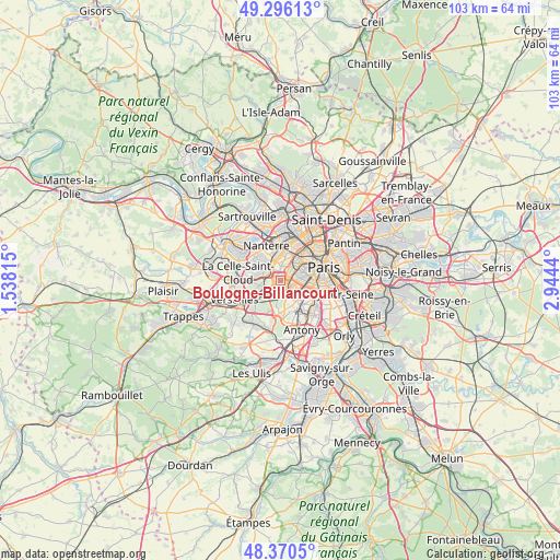
Boulogne-Billancourt GPS coordinates[2]
48° 50' 7.62" North, 2° 14' 28.608" East
| Map corner | latitude | longitude |
|---|---|---|
| Upper-left | 49.29613°, | 1.53815° |
| Center: | 48.83545°, | 2.24128° |
| Lower-right: | 48.3705°, | 2.9444° |
| Map W x H: | 102.9×102.9 km | = 63.9×63.9mi |
| max Lat: | 51.07786° ⇑23.7% North |
| Boulogne-Billancourt: | 48.83545° |
| min Lat: | ⇓76.3% South 41.3874° |
| min Long | Boulogne-Billan | max Long |
| -5.08615° | 2.24128° | 9.52242° |
| W 46.3%⇐ | ⇒53.7% E |
Elevation
Elevation of Boulogne-Billancourt is 35 m = 115 ft, and this is 158.7 m = 521 ft below average elevation for this country.
| Max E: |
2333 m = 7654 ft | 87.8% |
| Avg. | 193.7 m = 635 ft | |
| Boulogne-Billancourt | 35 m = 115 ft | |
Min E: |
-1 m = -3 ft | 12.2% |
See also: Boulogne-Billancourt elevation on elevation.city.
Geographical zone
Boulogne-Billancourt is located in North temperate zone (between Tropic of Cancer and the Arctic Circle). Distance of this North polar circle is 1971.2 km =1224.8 mi to North.| Distance of | km | miles | from Boulogne-Billancourt |
|---|---|---|---|
| North Pole | 4577.1 | 2844.1 | to North |
| Arctic Circle | 1971.2 | 1224.8 | to North |
| Tropic Cancer | 2824.1 | 1754.8 | to South |
| Equator | 5430 | 3374 | to South |


Nearby cities:
15 places around Boulogne-Billancourt: (largest is in red/bold)
• Chaville
5.1 km =3.2 mi,  229°
229°
• Châtillon
5.3 km =3.3 mi,  133°
133°
• Clamart
4.1 km =2.5 mi,  152°
152°
• Garches
4.4 km =2.7 mi,  279°
279°
• Issy-les-Moulineaux
3.1 km =1.9 mi,  121°
121°
• Le Plessis-Robinson
5.6 km =3.5 mi,  157°
157°
• Malakoff
4.6 km =2.9 mi,  111°
111°
• Marnes-la-Coquette
5.2 km =3.2 mi,  259°
259°
• Meudon
2.4 km =1.5 mi,  190°
190°
• Puteaux
5.3 km =3.3 mi,  358°
358°
• Saint-Cloud
3 km =1.9 mi,  292°
292°
• Suresnes
4.1 km =2.5 mi,  347°
347°
• Sèvres
2.2 km =1.4 mi, 231°
• Vanves
3.8 km =2.4 mi, 110°
• Ville-d’Avray
3.8 km =2.4 mi,  249°
249°
Sources, notices
• [Note1] Compared only with cities in France existing in our database
• [Src1] Map data: © OpenStreetMap contributors (CC-BY-SA)
• [Src2] Other city data from geonames.org with taken over terms of usage.
• [Src3] Geographical zone / Annual Mean Temperature by Robert A. Rohde @ Wikipedia
