Illifaut geodata
Illifaut (Brittany) is a populated place; located in France in Europe/Paris (GMT+2) time zone. With population of 660 people, there are 12381 cities with bigger population in this country. Compared to other cities in France, 61.9% of cities are located further ↓South; 95.9% of cities are located further →East and 55.6% of cities have higher elevation than Illifaut. Note1
Administrative division(s):
- Level 1: Brittany
- Level 2: Département des Côtes-d’Armor
- Level 3: Arrondissement de Saint-Brieuc
- Level 4: Illifaut


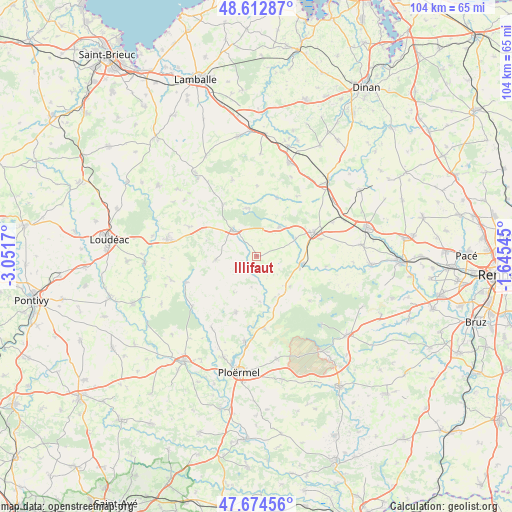
Illifaut GPS coordinates[2]
48° 8' 45.096" North, 2° 20' 54.852" West
| Map corner | latitude | longitude |
|---|---|---|
| Upper-left | 48.61287°, | -3.0517° |
| Center: | 48.14586°, | -2.34857° |
| Lower-right: | 47.67456°, | -1.64545° |
| Map W x H: | 104.3×104.3 km | = 64.8×64.8mi |
| max Lat: | 51.07786° ⇑38.1% North |
| Illifaut: | 48.14586° |
| min Lat: | ⇓61.9% South 41.3874° |
| min Long | Illifaut | max Long |
| -5.08615° | -2.34857° | 9.52242° |
| W 4.1%⇐ | ⇒95.9% E |
Elevation
Elevation of Illifaut is 115 m = 377 ft, and this is 78.7 m = 258 ft below average elevation for this country.
| Max E: |
2333 m = 7654 ft | 55.6% |
| Avg. | 193.7 m = 635 ft | |
| Illifaut | 115 m = 377 ft | |
Min E: |
-1 m = -3 ft | 44.4% |
See also: France elevation on elevation.city.
Geographical zone
Illifaut is located in North temperate zone (between Tropic of Cancer and the Arctic Circle). Distance of this North polar circle is 2047.9 km =1272.5 mi to North.| Distance of | km | miles | from Illifaut |
|---|---|---|---|
| North Pole | 4653.7 | 2891.7 | to North |
| Arctic Circle | 2047.9 | 1272.5 | to North |
| Tropic Cancer | 2747.4 | 1707.2 | to South |
| Equator | 5353.3 | 3326.4 | to South |


Nearby cities:
15 places around Illifaut: (largest is in red/bold)
• Concoret
14 km =8.7 mi,  130°
130°
• Gaël
9.5 km =5.9 mi,  99°
99°
• Guilliers
12.2 km =7.6 mi,  200°
200°
• Lanrelas
12.1 km =7.5 mi,  17°
17°
• Loscouët-sur-Meu
8.7 km =5.4 mi,  65°
65°
• Mauron
8.5 km =5.3 mi,  146°
146°
• Merdrignac
7.3 km =4.5 mi,  317°
317°
• Muel
14.3 km =8.9 mi, 98°
• Ménéac
8.4 km =5.2 mi,  265°
265°
• Plumaugat
14.6 km =9.1 mi,  33°
33°
• Saint-Méen-le-Grand
12.4 km =7.7 mi, 66°
• Saint-Onen-la-Chapelle
13.4 km =8.3 mi,  75°
75°
• Saint-Vran
12.2 km =7.6 mi,  325°
325°
• Trémorel
7.4 km =4.6 mi,  36°
36°
• Éréac
14.3 km =8.9 mi,  0°
0°
Sources, notices
• [Note1] Compared only with cities in France existing in our database
• [Src1] Map data: © OpenStreetMap contributors (CC-BY-SA)
• [Src2] Other city data from geonames.org with taken over terms of usage.
• [Src3] Geographical zone / Annual Mean Temperature by Robert A. Rohde @ Wikipedia
