Merdrignac geodata
Merdrignac (Brittany) is a populated place; located in France in Europe/Paris (GMT+2) time zone. With population of 3,159 people, there are 3082 cities with bigger population in this country. Compared to other cities in France, 62.7% of cities are located further ↓South; 96% of cities are located further →East and 54.7% of cities have lower elevation than Merdrignac. Note1
Administrative division(s):
- Level 1: Brittany
- Level 2: Département des Côtes-d’Armor
- Level 3: Arrondissement de Saint-Brieuc
- Level 4: Merdrignac


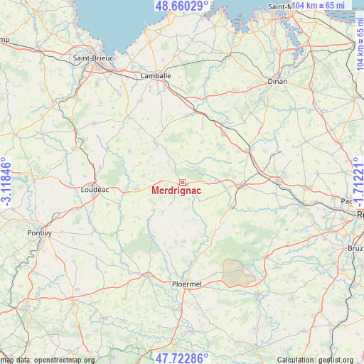
Merdrignac GPS coordinates[2]
48° 11' 37.392" North, 2° 24' 55.188" West
| Map corner | latitude | longitude |
|---|---|---|
| Upper-left | 48.66029°, | -3.11846° |
| Center: | 48.19372°, | -2.41533° |
| Lower-right: | 47.72286°, | -1.71221° |
| Map W x H: | 104.2×104.2 km | = 64.7×64.7mi |
| max Lat: | 51.07786° ⇑37.3% North |
| Merdrignac: | 48.19372° |
| min Lat: | ⇓62.7% South 41.3874° |
| min Long | Merdrignac | max Long |
| -5.08615° | -2.41533° | 9.52242° |
| W 4%⇐ | ⇒96% E |
Elevation
Elevation of Merdrignac is 149 m = 489 ft, and this is 44.7 m = 147 ft below average elevation for this country.
| Max E: |
2333 m = 7654 ft | 45.3% |
| Avg. | 193.7 m = 635 ft | |
| Merdrignac | 149 m = 489 ft | |
Min E: |
-1 m = -3 ft | 54.7% |
See also: France elevation on elevation.city.
Geographical zone
Merdrignac is located in North temperate zone (between Tropic of Cancer and the Arctic Circle). Distance of this North polar circle is 2042.5 km =1269.2 mi to North.| Distance of | km | miles | from Merdrignac |
|---|---|---|---|
| North Pole | 4648.4 | 2888.4 | to North |
| Arctic Circle | 2042.5 | 1269.2 | to North |
| Tropic Cancer | 2752.7 | 1710.4 | to South |
| Equator | 5358.6 | 3329.7 | to South |


Nearby cities:
15 places around Merdrignac: (largest is in red/bold)
• Collinée
14 km =8.7 mi,  327°
327°
• Illifaut
7.3 km =4.5 mi,  137°
137°
• La Trinité-Porhoët
14.3 km =8.9 mi,  221°
221°
• Langourla
10.1 km =6.3 mi,  0°
0°
• Lanrelas
10.6 km =6.6 mi,  53°
53°
• Laurenan
8.9 km =5.5 mi,  273°
273°
• Loscouët-sur-Meu
12.9 km =8 mi,  97°
97°
• Ménéac
6.9 km =4.3 mi,  209°
209°
• Plumaugat
14.8 km =9.2 mi,  62°
62°
• Plémet
13.3 km =8.3 mi,  261°
261°
• Saint-Gouéno
14 km =8.7 mi,  306°
306°
• Saint-Jacut-du-Mené
11 km =6.8 mi, 332°
• Saint-Vran
5.1 km =3.2 mi,  336°
336°
• Trémorel
9.4 km =5.8 mi,  86°
86°
• Éréac
10.3 km =6.4 mi,  29°
29°
Sources, notices
• [Note1] Compared only with cities in France existing in our database
• [Src1] Map data: © OpenStreetMap contributors (CC-BY-SA)
• [Src2] Other city data from geonames.org with taken over terms of usage.
• [Src3] Geographical zone / Annual Mean Temperature by Robert A. Rohde @ Wikipedia
