Ménéac geodata
Ménéac (Brittany) is a populated place; located in France in Europe/Paris (GMT+2) time zone. With population of 1,808 people, there are 5246 cities with bigger population in this country. Compared to other cities in France, 61.9% of cities are located further ↓South; 96.2% of cities are located further →East and 60% of cities have lower elevation than Ménéac. Note1
Administrative division(s):
- Level 1: Brittany
- Level 2: Morbihan
- Level 3: Arrondissement de Pontivy
- Level 4: Ménéac


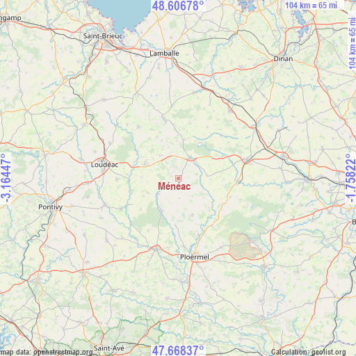
Ménéac GPS coordinates[2]
48° 8' 22.992" North, 2° 27' 40.824" West
| Map corner | latitude | longitude |
|---|---|---|
| Upper-left | 48.60678°, | -3.16447° |
| Center: | 48.13972°, | -2.46134° |
| Lower-right: | 47.66837°, | -1.75822° |
| Map W x H: | 104.3×104.3 km | = 64.8×64.8mi |
| max Lat: | 51.07786° ⇑38.1% North |
| Ménéac: | 48.13972° |
| min Lat: | ⇓61.9% South 41.3874° |
| min Long | Ménéac | max Long |
| -5.08615° | -2.46134° | 9.52242° |
| W 3.8%⇐ | ⇒96.2% E |
Elevation
Elevation of Ménéac is 170 m = 558 ft, and this is 23.7 m = 78 ft below average elevation for this country.
| Max E: |
2333 m = 7654 ft | 40% |
| Avg. | 193.7 m = 635 ft | |
| Ménéac | 170 m = 558 ft | |
Min E: |
-1 m = -3 ft | 60% |
See also: France elevation on elevation.city.
Geographical zone
Ménéac is located in North temperate zone (between Tropic of Cancer and the Arctic Circle). Distance of this North polar circle is 2048.5 km =1272.9 mi to North.| Distance of | km | miles | from Ménéac |
|---|---|---|---|
| North Pole | 4654.4 | 2892.1 | to North |
| Arctic Circle | 2048.5 | 1272.9 | to North |
| Tropic Cancer | 2746.7 | 1706.7 | to South |
| Equator | 5352.6 | 3326 | to South |


Nearby cities:
15 places around Ménéac: (largest is in red/bold)
• Guilliers
11.5 km =7.1 mi,  158°
158°
• Illifaut
8.4 km =5.2 mi,  85°
85°
• La Chèze
14.5 km =9 mi,  266°
266°
• La Prénessaye
13.8 km =8.6 mi,  290°
290°
• La Trinité-Porhoët
7.7 km =4.8 mi,  232°
232°
• Laurenan
8.5 km =5.3 mi,  320°
320°
• Le Cambout
14.3 km =8.9 mi, 230°
• Mauron
14.6 km =9.1 mi,  115°
115°
• Merdrignac
6.9 km =4.3 mi,  29°
29°
• Mohon
10.8 km =6.7 mi,  206°
206°
• Plumieux
10 km =6.2 mi,  245°
245°
• Plémet
10.6 km =6.6 mi, 292°
• Saint-Malo-des-Trois-Fontaines
14 km =8.7 mi,  183°
183°
• Saint-Vran
10.8 km =6.7 mi,  7°
7°
• Trémorel
14.4 km =8.9 mi,  62°
62°
Sources, notices
• [Note1] Compared only with cities in France existing in our database
• [Src1] Map data: © OpenStreetMap contributors (CC-BY-SA)
• [Src2] Other city data from geonames.org with taken over terms of usage.
• [Src3] Geographical zone / Annual Mean Temperature by Robert A. Rohde @ Wikipedia
