Guilliers geodata
Guilliers (Brittany) is a populated place; located in France in Europe/Paris (GMT+2) time zone. With population of 1,453 people, there are 6358 cities with bigger population in this country. Compared to other cities in France, 60.1% of cities are located further ↓South; 96% of cities are located further →East and 65.3% of cities have higher elevation than Guilliers. Note1
Administrative division(s):
- Level 1: Brittany
- Level 2: Morbihan
- Level 3: Arrondissement de Pontivy
- Level 4: Guilliers


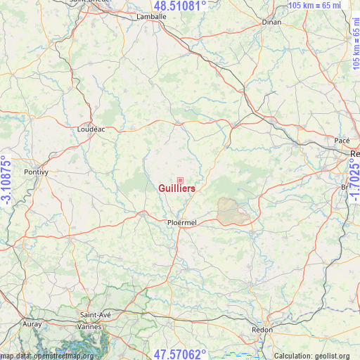
Guilliers GPS coordinates[2]
48° 2' 34.296" North, 2° 24' 20.232" West
| Map corner | latitude | longitude |
|---|---|---|
| Upper-left | 48.51081°, | -3.10875° |
| Center: | 48.04286°, | -2.40562° |
| Lower-right: | 47.57062°, | -1.7025° |
| Map W x H: | 104.5×104.5 km | = 64.9×64.9mi |
| max Lat: | 51.07786° ⇑39.9% North |
| Guilliers: | 48.04286° |
| min Lat: | ⇓60.1% South 41.3874° |
| min Long | Guilliers | max Long |
| -5.08615° | -2.40562° | 9.52242° |
| W 4%⇐ | ⇒96% E |
Elevation
Elevation of Guilliers is 89 m = 292 ft, and this is 104.7 m = 344 ft below average elevation for this country.
| Max E: |
2333 m = 7654 ft | 65.3% |
| Avg. | 193.7 m = 635 ft | |
| Guilliers | 89 m = 292 ft | |
Min E: |
-1 m = -3 ft | 34.7% |
See also: France elevation on elevation.city.
Geographical zone
Guilliers is located in North temperate zone (between Tropic of Cancer and the Arctic Circle). Distance of this North polar circle is 2059.3 km =1279.6 mi to North.| Distance of | km | miles | from Guilliers |
|---|---|---|---|
| North Pole | 4665.2 | 2898.8 | to North |
| Arctic Circle | 2059.3 | 1279.6 | to North |
| Tropic Cancer | 2735.9 | 1700 | to South |
| Equator | 5341.9 | 3319.3 | to South |


Nearby cities:
15 places around Guilliers: (largest is in red/bold)
• Campénéac
12.7 km =7.9 mi,  138°
138°
• Illifaut
12.2 km =7.6 mi,  20°
20°
• Josselin
14.2 km =8.8 mi,  227°
227°
• La Croix-Helléan
11.9 km =7.4 mi,  216°
216°
• La Trinité-Porhoët
11.9 km =7.4 mi,  300°
300°
• Lanouée
13.8 km =8.6 mi,  250°
250°
• Loyat
6.2 km =3.9 mi,  164°
164°
• Mauron
10 km =6.2 mi,  63°
63°
• Mohon
9 km =5.6 mi,  276°
276°
• Ménéac
11.5 km =7.1 mi,  338°
338°
• Néant-sur-Yvel
6.6 km =4.1 mi,  120°
120°
• Ploërmel
12.4 km =7.7 mi,  177°
177°
• Plumieux
14.8 km =9.2 mi, 296°
• Saint-Malo-des-Trois-Fontaines
5.9 km =3.7 mi,  237°
237°
• Taupont
9.6 km =6 mi,  195°
195°
Sources, notices
• [Note1] Compared only with cities in France existing in our database
• [Src1] Map data: © OpenStreetMap contributors (CC-BY-SA)
• [Src2] Other city data from geonames.org with taken over terms of usage.
• [Src3] Geographical zone / Annual Mean Temperature by Robert A. Rohde @ Wikipedia
