Le Pin-la-Garenne geodata
Le Pin-la-Garenne (Normandy) is a populated place; located in France in Europe/Paris (GMT+2) time zone. With population of 652 people, there are 12498 cities with bigger population in this country. Compared to other cities in France, 67.1% of cities are located further ↓South; 73% of cities are located further →East and 59.8% of cities have lower elevation than Le Pin-la-Garenne. Note1
Administrative division(s):
- Level 1: Normandy
- Level 2: Département de l'Orne
- Level 3: Arrondissement de Mortagne-au-Perche
- Level 4: Le Pin-la-Garenne


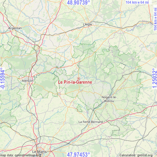
Le Pin-la-Garenne GPS coordinates[2]
48° 26' 35.16" North, 0° 32' 49.884" East
| Map corner | latitude | longitude |
|---|---|---|
| Upper-left | 48.90739°, | -0.15594° |
| Center: | 48.4431°, | 0.54719° |
| Lower-right: | 47.97453°, | 1.25032° |
| Map W x H: | 103.7×103.7 km | = 64.4×64.4mi |
| max Lat: | 51.07786° ⇑32.9% North |
| Le Pin-la-Garenne: | 48.4431° |
| min Lat: | ⇓67.1% South 41.3874° |
| min Long | Le Pin-la-Garen | max Long |
| -5.08615° | 0.54719° | 9.52242° |
| W 27%⇐ | ⇒73% E |
Elevation
Elevation of Le Pin-la-Garenne is 169 m = 554 ft, and this is 24.7 m = 81 ft below average elevation for this country.
| Max E: |
2333 m = 7654 ft | 40.2% |
| Avg. | 193.7 m = 635 ft | |
| Le Pin-la-Garenne | 169 m = 554 ft | |
Min E: |
-1 m = -3 ft | 59.8% |
See also: France elevation on elevation.city.
Geographical zone
Le Pin-la-Garenne is located in North temperate zone (between Tropic of Cancer and the Arctic Circle). Distance of this North polar circle is 2014.8 km =1251.9 mi to North.| Distance of | km | miles | from Le Pin-la-Garenne |
|---|---|---|---|
| North Pole | 4620.7 | 2871.2 | to North |
| Arctic Circle | 2014.8 | 1251.9 | to North |
| Tropic Cancer | 2780.4 | 1727.7 | to South |
| Equator | 5386.4 | 3347 | to South |


Nearby cities:
15 places around Le Pin-la-Garenne: (largest is in red/bold)
• Bazoches-sur-Hoëne
13.2 km =8.2 mi,  336°
336°
• Bellême
7.9 km =4.9 mi,  167°
167°
• Igé
13.3 km =8.3 mi,  188°
188°
• La Chapelle-Montligeon
9.1 km =5.7 mi,  61°
61°
• Le Gué-de-la-Chaîne
7.9 km =4.9 mi, 194°
• Le Mêle-sur-Sarthe
16.1 km =10 mi,  298°
298°
• Mamers
16.7 km =10.4 mi,  231°
231°
• Mauves-sur-Huisne
5.5 km =3.4 mi,  81°
81°
• Mortagne-au-Perche
8.6 km =5.3 mi,  0°
0°
• Nocé
12.2 km =7.6 mi,  125°
125°
• Rémalard
16.7 km =10.4 mi,  95°
95°
• Saint-Hilaire-le-Châtel
13.4 km =8.3 mi,  353°
353°
• Saint-Julien-sur-Sarthe
14.9 km =9.3 mi,  290°
290°
• Saint-Langis-lès-Mortagne
8 km =5 mi, 1°
• Saint-Martin-du-Vieux-Bellême
7 km =4.3 mi,  182°
182°
Sources, notices
• [Note1] Compared only with cities in France existing in our database
• [Src1] Map data: © OpenStreetMap contributors (CC-BY-SA)
• [Src2] Other city data from geonames.org with taken over terms of usage.
• [Src3] Geographical zone / Annual Mean Temperature by Robert A. Rohde @ Wikipedia
