Bellême geodata
Bellême (Normandy) is a populated place; located in France in Europe/Paris (GMT+2) time zone. With population of 1,803 people, there are 5268 cities with bigger population in this country. Compared to other cities in France, 65.9% of cities are located further ↓South; 72.7% of cities are located further →East and 70.1% of cities have lower elevation than Bellême. Note1
Administrative division(s):
- Level 1: Normandy
- Level 2: Département de l'Orne
- Level 3: Arrondissement de Mortagne-au-Perche
- Level 4: Bellême


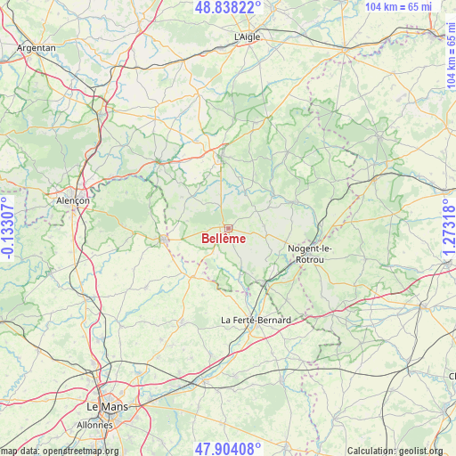
Bellême GPS coordinates[2]
48° 22' 23.844" North, 0° 34' 12.18" East
| Map corner | latitude | longitude |
|---|---|---|
| Upper-left | 48.83822°, | -0.13307° |
| Center: | 48.37329°, | 0.57005° |
| Lower-right: | 47.90408°, | 1.27318° |
| Map W x H: | 103.9×103.9 km | = 64.6×64.6mi |
| max Lat: | 51.07786° ⇑34.1% North |
| Bellême: | 48.37329° |
| min Lat: | ⇓65.9% South 41.3874° |
| min Long | Bellême | max Long |
| -5.08615° | 0.57005° | 9.52242° |
| W 27.3%⇐ | ⇒72.7% E |
Elevation
Elevation of Bellême is 220 m = 722 ft, and this is 26.3 m = 86 ft above average elevation for this country.
| Max E: |
2333 m = 7654 ft | 29.9% |
| Bellême | 220 m 722 ft | |
| Avg. | 193.7 m = 635 ft | |
Min E: |
-1 m = -3 ft | 70.1% |
See also: France elevation on elevation.city.
Geographical zone
Bellême is located in North temperate zone (between Tropic of Cancer and the Arctic Circle). Distance of this North polar circle is 2022.6 km =1256.8 mi to North.| Distance of | km | miles | from Bellême |
|---|---|---|---|
| North Pole | 4628.5 | 2876 | to North |
| Arctic Circle | 2022.6 | 1256.8 | to North |
| Tropic Cancer | 2772.7 | 1722.9 | to South |
| Equator | 5378.6 | 3342.1 | to South |


Nearby cities:
15 places around Bellême: (largest is in red/bold)
• Igé
6.5 km =4 mi,  213°
213°
• La Chapelle-Montligeon
13.7 km =8.5 mi,  27°
27°
• La Rouge
14 km =8.7 mi,  132°
132°
• Le Gué-de-la-Chaîne
3.7 km =2.3 mi,  271°
271°
• Le Pin-la-Garenne
7.9 km =4.9 mi,  347°
347°
• Mamers
15.1 km =9.4 mi,  259°
259°
• Mauves-sur-Huisne
9.4 km =5.8 mi,  23°
23°
• Nocé
8.2 km =5.1 mi,  85°
85°
• Préaux-du-Perche
11.7 km =7.3 mi,  112°
112°
• Préval
15.8 km =9.8 mi,  165°
165°
• Saint-Cosme-en-Vairais
14.1 km =8.8 mi, 212°
• Saint-Germain-de-la-Coudre
10.6 km =6.6 mi, 165°
• Saint-Hilaire-sur-Erre
14.2 km =8.8 mi,  118°
118°
• Saint-Martin-du-Vieux-Bellême
2.1 km =1.3 mi,  292°
292°
• Saint-Rémy-des-Monts
14.4 km =8.9 mi,  240°
240°
Sources, notices
• [Note1] Compared only with cities in France existing in our database
• [Src1] Map data: © OpenStreetMap contributors (CC-BY-SA)
• [Src2] Other city data from geonames.org with taken over terms of usage.
• [Src3] Geographical zone / Annual Mean Temperature by Robert A. Rohde @ Wikipedia
