Hurigny geodata
Hurigny (Bourgogne-Franche-Comté) is a populated place; located in France in Europe/Paris (GMT+2) time zone. With population of 1,533 people, there are 6071 cities with bigger population in this country. Compared to other cities in France, 61.7% of cities are located further ↑North; 75% of cities are located further ←West and 81.5% of cities have lower elevation than Hurigny. Note1
Administrative division(s):
- Level 1: Bourgogne-Franche-Comté
- Level 2: Département de Saône-et-Loire
- Level 3: Arrondissement de Mâcon
- Level 4: Hurigny


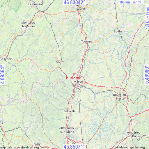
Hurigny GPS coordinates[2]
46° 20' 49.992" North, 4° 47' 48.336" East
| Map corner | latitude | longitude |
|---|---|---|
| Upper-left | 46.83042°, | 4.09364° |
| Center: | 46.34722°, | 4.79676° |
| Lower-right: | 45.85971°, | 5.49989° |
| Map W x H: | 107.9×107.9 km | = 67×67mi |
| max Lat: | 51.07786° ⇑61.7% North |
| Hurigny: | 46.34722° |
| min Lat: | ⇓38.3% South 41.3874° |
| min Long | Hurigny | max Long |
| -5.08615° | 4.79676° | 9.52242° |
| W 75%⇐ | ⇒25% E |
Elevation
Elevation of Hurigny is 305 m = 1001 ft, and this is 111.3 m = 365 ft above average elevation for this country.
| Max E: |
2333 m = 7654 ft | 18.5% |
| Hurigny | 305 m 1001 ft | |
| Avg. | 193.7 m = 635 ft | |
Min E: |
-1 m = -3 ft | 81.5% |
See also: France elevation on elevation.city.
Geographical zone
Hurigny is located in North temperate zone (between Tropic of Cancer and the Arctic Circle). Distance of this North polar circle is 2247.8 km =1396.7 mi to North.| Distance of | km | miles | from Hurigny |
|---|---|---|---|
| North Pole | 4853.7 | 3015.9 | to North |
| Arctic Circle | 2247.8 | 1396.7 | to North |
| Tropic Cancer | 2547.4 | 1582.9 | to South |
| Equator | 5153.3 | 3202.1 | to South |


Nearby cities:
15 places around Hurigny: (largest is in red/bold)
• Berzé-la-Ville
7.3 km =4.5 mi,  284°
284°
• Bussières
6.9 km =4.3 mi,  260°
260°
• Charnay-lès-Mâcon
4.5 km =2.8 mi,  191°
191°
• Davayé
6.4 km =4 mi,  220°
220°
• Feillens
7.4 km =4.6 mi,  101°
101°
• Igé
7.1 km =4.4 mi,  322°
322°
• La Roche-Vineuse
5.9 km =3.7 mi,  267°
267°
• Laizé
5.4 km =3.4 mi,  7°
7°
• Mâcon
4.4 km =2.7 mi,  146°
146°
• Prissé
4.9 km =3 mi,  234°
234°
• Saint-Laurent-sur-Saône
5.8 km =3.6 mi,  143°
143°
• Saint-Martin-Belle-Roche
6 km =3.7 mi,  48°
48°
• Sancé
2.7 km =1.7 mi,  108°
108°
• Senozan
7.4 km =4.6 mi,  43°
43°
• Verzé
5.7 km =3.5 mi,  305°
305°
Sources, notices
• [Note1] Compared only with cities in France existing in our database
• [Src1] Map data: © OpenStreetMap contributors (CC-BY-SA)
• [Src2] Other city data from geonames.org with taken over terms of usage.
• [Src3] Geographical zone / Annual Mean Temperature by Robert A. Rohde @ Wikipedia
