Horbourg-Wihr geodata
Horbourg-Wihr (Grand Est) is a populated place; located in France in Europe/Paris (GMT+2) time zone. With population of 5,358 people, there are 1840 cities with bigger population in this country. Compared to other cities in France, 60.8% of cities are located further ↓South; 97.2% of cities are located further ←West and 63.8% of cities have lower elevation than Horbourg-Wihr. Note1
Administrative division(s):
- Level 1: Grand Est
- Level 2: Haut-Rhin
- Level 3: Arrondissement de Colmar-Ribeauvillé
- Level 4: Horbourg-Wihr


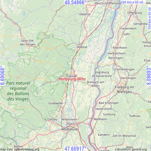
Horbourg-Wihr GPS coordinates[2]
48° 4' 51.816" North, 7° 23' 37.68" East
| Map corner | latitude | longitude |
|---|---|---|
| Upper-left | 48.54866°, | 6.69068° |
| Center: | 48.08106°, | 7.3938° |
| Lower-right: | 47.60917°, | 8.09693° |
| Map W x H: | 104.5×104.5 km | = 64.9×64.9mi |
| max Lat: | 51.07786° ⇑39.2% North |
| Horbourg-Wihr: | 48.08106° |
| min Lat: | ⇓60.8% South 41.3874° |
| min Long | Horbourg-Wihr | max Long |
| -5.08615° | 7.3938° | 9.52242° |
| W 97.2%⇐ | ⇒2.8% E |
Elevation
Elevation of Horbourg-Wihr is 188 m = 617 ft, and this is 5.7 m = 19 ft below average elevation for this country.
| Max E: |
2333 m = 7654 ft | 36.2% |
| Avg. | 193.7 m = 635 ft | |
| Horbourg-Wihr | 188 m = 617 ft | |
Min E: |
-1 m = -3 ft | 63.8% |
See also: France elevation on elevation.city.
Geographical zone
Horbourg-Wihr is located in North temperate zone (between Tropic of Cancer and the Arctic Circle). Distance of this North polar circle is 2055.1 km =1277 mi to North.| Distance of | km | miles | from Horbourg-Wihr |
|---|---|---|---|
| North Pole | 4660.9 | 2896.1 | to North |
| Arctic Circle | 2055.1 | 1277 | to North |
| Tropic Cancer | 2740.2 | 1702.7 | to South |
| Equator | 5346.1 | 3321.9 | to South |


Nearby cities:
15 places around Horbourg-Wihr: (largest is in red/bold)
• Andolsheim
2.7 km =1.7 mi,  141°
141°
• Bischwihr
3.7 km =2.3 mi,  61°
61°
• Colmar
2.8 km =1.7 mi,  269°
269°
• Fortschwihr
4.3 km =2.7 mi,  79°
79°
• Holtzwihr
4.1 km =2.5 mi,  29°
29°
• Houssen
5.1 km =3.2 mi,  346°
346°
• Ingersheim
7 km =4.3 mi,  285°
285°
• Jebsheim
7.7 km =4.8 mi,  52°
52°
• Logelheim
6.8 km =4.2 mi,  171°
171°
• Muntzenheim
6.5 km =4 mi,  69°
69°
• Sundhoffen
4.5 km =2.8 mi,  161°
161°
• Urschenheim
6.7 km =4.2 mi, 84°
• Wettolsheim
7.6 km =4.7 mi,  249°
249°
• Wickerschwihr
4.3 km =2.7 mi, 45°
• Widensolen
6.7 km =4.2 mi,  106°
106°
Sources, notices
• [Note1] Compared only with cities in France existing in our database
• [Src1] Map data: © OpenStreetMap contributors (CC-BY-SA)
• [Src2] Other city data from geonames.org with taken over terms of usage.
• [Src3] Geographical zone / Annual Mean Temperature by Robert A. Rohde @ Wikipedia
