Andolsheim geodata
Andolsheim (Grand Est) is a populated place; located in France in Europe/Paris (GMT+2) time zone. With population of 2,107 people, there are 4577 cities with bigger population in this country. Compared to other cities in France, 60.4% of cities are located further ↓South; 97.4% of cities are located further ←West and 64% of cities have lower elevation than Andolsheim. Note1
Administrative division(s):
- Level 1: Grand Est
- Level 2: Haut-Rhin
- Level 3: Arrondissement de Colmar-Ribeauvillé
- Level 4: Andolsheim


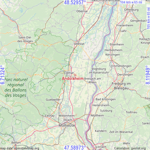
Andolsheim GPS coordinates[2]
48° 3' 42.444" North, 7° 24' 58.932" East
| Map corner | latitude | longitude |
|---|---|---|
| Upper-left | 48.52957°, | 6.71324° |
| Center: | 48.06179°, | 7.41637° |
| Lower-right: | 47.58973°, | 8.11949° |
| Map W x H: | 104.5×104.5 km | = 64.9×64.9mi |
| max Lat: | 51.07786° ⇑39.6% North |
| Andolsheim: | 48.06179° |
| min Lat: | ⇓60.4% South 41.3874° |
| min Long | Andolsheim | max Long |
| -5.08615° | 7.41637° | 9.52242° |
| W 97.4%⇐ | ⇒2.6% E |
Elevation
Elevation of Andolsheim is 189 m = 620 ft, and this is 4.7 m = 15 ft below average elevation for this country.
| Max E: |
2333 m = 7654 ft | 36% |
| Avg. | 193.7 m = 635 ft | |
| Andolsheim | 189 m = 620 ft | |
Min E: |
-1 m = -3 ft | 64% |
See also: France elevation on elevation.city.
Geographical zone
Andolsheim is located in North temperate zone (between Tropic of Cancer and the Arctic Circle). Distance of this North polar circle is 2057.2 km =1278.3 mi to North.| Distance of | km | miles | from Andolsheim |
|---|---|---|---|
| North Pole | 4663.1 | 2897.5 | to North |
| Arctic Circle | 2057.2 | 1278.3 | to North |
| Tropic Cancer | 2738.1 | 1701.4 | to South |
| Equator | 5344 | 3320.6 | to South |


Nearby cities:
15 places around Andolsheim: (largest is in red/bold)
• Bischwihr
4.2 km =2.6 mi,  21°
21°
• Colmar
5 km =3.1 mi,  295°
295°
• Durrenentzen
7.2 km =4.5 mi,  61°
61°
• Fortschwihr
3.9 km =2.4 mi,  40°
40°
• Holtzwihr
5.7 km =3.5 mi,  3°
3°
• Horbourg-Wihr
2.7 km =1.7 mi,  321°
321°
• Houssen
7.7 km =4.8 mi,  337°
337°
• Logelheim
4.7 km =2.9 mi,  188°
188°
• Muntzenheim
6.2 km =3.9 mi,  45°
45°
• Sainte-Croix-en-Plaine
6.3 km =3.9 mi,  201°
201°
• Sundhoffen
2.1 km =1.3 mi, 186°
• Urschenheim
5.8 km =3.6 mi, 61°
• Wickerschwihr
5.3 km =3.3 mi,  14°
14°
• Widensolen
4.7 km =2.9 mi,  87°
87°
• Wolfgantzen
7.3 km =4.5 mi,  120°
120°
Sources, notices
• [Note1] Compared only with cities in France existing in our database
• [Src1] Map data: © OpenStreetMap contributors (CC-BY-SA)
• [Src2] Other city data from geonames.org with taken over terms of usage.
• [Src3] Geographical zone / Annual Mean Temperature by Robert A. Rohde @ Wikipedia
